- Kadoka, South Dakota
Infobox Settlement
official_name = Kadoka, South Dakota
other_name =
native_name =
nickname =
settlement_type =City
motto =
imagesize =
image_caption =
flag_size =
image_
seal_size =
image_shield =
shield_size =
image_blank_emblem =
blank_emblem_type =
blank_emblem_size =
imagesize =
image_caption =
flag_size =
image_
seal_size =
image_shield =
shield_size =
image_blank_emblem =
blank_emblem_type =
blank_emblem_size =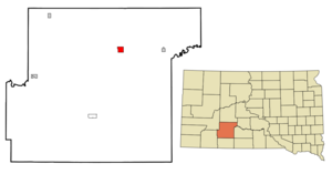
mapsize = 250px
map_caption = Location in Jackson County and the state ofSouth Dakota
mapsize1 =
map_caption1 =
image_dot_
dot_mapsize =
dot_map_caption =
dot_x =
dot_y =
pushpin_
pushpin_label_position =
pushpin_map_caption =
pushpin_mapsize =
subdivision_type = Country
subdivision_name =United States
subdivision_type1 = State
subdivision_name1 =South Dakota
subdivision_type2 = County
subdivision_name2 = Jackson
subdivision_type3 =
subdivision_name3 =
subdivision_type4 =
subdivision_name4 =
government_footnotes =
government_type =
leader_title =
leader_name =
leader_title1 =
leader_name1 =
leader_title2 =
leader_name2 =
leader_title3 =
leader_name3 =
leader_title4 =
leader_name4 =
established_title =
established_date =
established_title2 =
established_date2 =
established_title3 =
established_date3 =
area_magnitude =
unit_pref = Imperial
area_footnotes =
area_total_km2 = 6
area_land_km2 = 6
area_water_km2 = 0
area_total_sq_mi = 2.3
area_land_sq_mi = 2.3
area_water_sq_mi = 0
area_water_percent =
area_urban_km2 =
area_urban_sq_mi =
area_metro_km2 =
area_metro_sq_mi =
area_blank1_title =
area_blank1_km2 =
area_blank1_sq_mi =
population_as_of = 2000
population_footnotes =
population_note =
population_total = 706
population_density_km2 = 117.7
population_density_sq_mi = 307
population_metro =
population_density_metro_km2 =
population_density_metro_sq_mi =
population_urban =
population_density_urban_km2 =
population_density_urban_sq_mi =
population_blank1_title =
population_blank1 =
population_density_blank1_km2 =
population_density_blank1_sq_mi =
timezone = Mountain (MST)
utc_offset = -7
timezone_DST = MDT
utc_offset_DST = -6
latd = 43 |latm = 50 |lats = 7 |latNS = N
longd = 101 |longm = 30 |longs = 44 |longEW = W
elevation_footnotes =
elevation_m = 752
elevation_ft = 2467
postal_code_type =ZIP code
postal_code = 57543
area_code = 605
blank_name = FIPS code
blank_info = 46-33180GR|2
blank1_name = GNIS feature ID
blank1_info = 1261905GR|3
website =
footnotes =Kadoka is a city in Jackson County,
South Dakota ,United States . The population was 706 at the 2000 census. It is thecounty seat of Jackson CountyGR|6.Geography
Kadoka is located at coor dms|43|50|7|N|101|30|44|W|city (43.835290, -101.512333)GR|1.
According to the
United States Census Bureau , the city has a total area of 2.3square mile s (6.0km² ), all of it land.Kadoka has been assigned the
ZIP code 57543 and theFIPS place code 33180.Demographics
As of the
census GR|2 of 2000, there were 706 people, 293 households, and 172 families residing in the city. Thepopulation density was 305.0 people per square mile (118.0/km²). There were 356 housing units at an average density of 153.8/sq mi (59.5/km²). The racial makeup of the city was 83.99% White, 0.14% African American, 13.03% Native American, 0.14% Asian, 0.14% from other races, and 2.55% from two or more races. Hispanic or Latino of any race were 0.28% of the population.There were 293 households out of which 29.4% had children under the age of 18 living with them, 48.8% were married couples living together, 9.6% had a female householder with no husband present, and 41.0% were non-families. 35.5% of all households were made up of individuals and 20.1% had someone living alone who was 65 years of age or older. The average household size was 2.33 and the average family size was 3.11.
In the city the population was spread out with 27.6% under the age of 18, 5.8% from 18 to 24, 21.4% from 25 to 44, 22.4% from 45 to 64, and 22.8% who were 65 years of age or older. The median age was 42 years. For every 100 females there were 86.3 males. For every 100 females age 18 and over, there were 80.6 males.
The median income for a household in the city was $26,875, and the median income for a family was $31,167. Males had a median income of $26,818 versus $18,750 for females. The
per capita income for the city was $13,758. About 10.5% of families and 13.8% of the population were below thepoverty line , including 22.0% of those under age 18 and 13.4% of those age 65 or over.Kadoka Airport
The City of Kadoka owns and operates the Kadoka airport. The airport has two turf runways. It is not entirely fenced so pedestrian traffic may approach the taxiways. The airport is located in the eastern part of the town near the Kadoka school athletic facilities.
Depot Museum
The town has a museum that occupies the building that used to be the train station. It is only open from 6 p.m. to 8 p.m. on certain days of the week.
References
External links
Wikimedia Foundation. 2010.