- Castlewood, South Dakota
Infobox Settlement
official_name = Castlewood, South Dakota
other_name =
native_name =
nickname =
settlement_type =City
motto =
imagesize =
image_caption =
flag_size =
image_
seal_size =
image_shield =
shield_size =
image_blank_emblem =
blank_emblem_type =
blank_emblem_size =
imagesize =
image_caption =
flag_size =
image_
seal_size =
image_shield =
shield_size =
image_blank_emblem =
blank_emblem_type =
blank_emblem_size =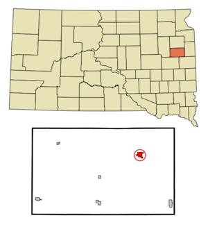
mapsize = 250px
map_caption = Location in Hamlin County and the state ofSouth Dakota
mapsize1 =
map_caption1 =
image_dot_
dot_mapsize =
dot_map_caption =
dot_x =
dot_y =
pushpin_
pushpin_label_position =
pushpin_map_caption =
pushpin_mapsize =
subdivision_type = Country
subdivision_name =United States
subdivision_type1 = State
subdivision_name1 =South Dakota
subdivision_type2 = County
subdivision_name2 = Hamlin
subdivision_type3 =
subdivision_name3 =
subdivision_type4 =
subdivision_name4 =
government_footnotes =
government_type =
leader_title =
leader_name =
leader_title1 =
leader_name1 =
leader_title2 =
leader_name2 =
leader_title3 =
leader_name3 =
leader_title4 =
leader_name4 =
established_title =
established_date =
established_title2 =
established_date2 =
established_title3 =
established_date3 =
area_magnitude =
unit_pref = Imperial
area_footnotes =
area_total_km2 = 2.9
area_land_km2 = 2.9
area_water_km2 = 0
area_total_sq_mi = 1.1
area_land_sq_mi = 1.1
area_water_sq_mi = 0
area_water_percent =
area_urban_km2 =
area_urban_sq_mi =
area_metro_km2 =
area_metro_sq_mi =
area_blank1_title =
area_blank1_km2 =
area_blank1_sq_mi =
population_as_of = 2000
population_footnotes =
population_note =
population_total = 666
population_density_km2 = 229.7
population_density_sq_mi = 605.5
population_metro =
population_density_metro_km2 =
population_density_metro_sq_mi =
population_urban =
population_density_urban_km2 =
population_density_urban_sq_mi =
population_blank1_title =
population_blank1 =
population_density_blank1_km2 =
population_density_blank1_sq_mi =
timezone = Central (CST)
utc_offset = -6
timezone_DST = CDT
utc_offset_DST = -5
latd = 44 |latm = 43 |lats = 24 |latNS = N
longd = 97 |longm = 1 |longs = 46 |longEW = W
elevation_footnotes =
elevation_m = 514
elevation_ft = 1686
postal_code_type =ZIP code
postal_code = 57223
area_code = 605
blank_name = FIPS code
blank_info = 46-10500GR|2
blank1_name = GNIS feature ID
blank1_info = 1265146GR|3
website =
footnotes =Castlewood is a city in Hamlin County,
South Dakota ,United States . It is part of theWatertown, South Dakota Micropolitan Statistical Area. The population was 666 at the 2000 census.Geography
Castlewood is located at coor dms|44|43|24|N|97|1|46|W|city (44.723262, -97.029505)GR|1, along the
Big Sioux River . [DeLorme (2001). "South Dakota Atlas & Gazetteer". Yarmouth, Maine: DeLorme. ISBN 0-89933-330-3]According to the
United States Census Bureau , the city has a total area of 1.1square mile s (3.0km² ), all of it land.Castlewood has been assigned the
ZIP code 57223 and theFIPS place code 10500.Demographics
As of the
census GR|2 of 2000, there were 666 people, 253 households, and 185 families residing in the city. Thepopulation density was 585.9 people per square mile (225.6/km²). There were 265 housing units at an average density of 233.1/sq mi (89.8/km²). The racial makeup of the city was 98.95% White, 0.45% Native American, and 0.60% from two or more races. Hispanic or Latino of any race were 0.30% of the population.There were 253 households out of which 40.3% had children under the age of 18 living with them, 60.5% were married couples living together, 7.9% had a female householder with no husband present, and 26.5% were non-families. 24.1% of all households were made up of individuals and 14.2% had someone living alone who was 65 years of age or older. The average household size was 2.57 and the average family size was 3.06.
In the city the population was spread out with 28.5% under the age of 18, 8.1% from 18 to 24, 26.6% from 25 to 44, 20.6% from 45 to 64, and 16.2% who were 65 years of age or older. The median age was 35 years. For every 100 females there were 94.7 males. For every 100 females age 18 and over, there were 91.9 males.
The median income for a household in the city was $36,607, and the median income for a family was $41,806. Males had a median income of $29,688 versus $20,750 for females. The
per capita income for the city was $17,682. About 7.7% of families and 7.1% of the population were below thepoverty line , including 12.0% of those under age 18 and 6.7% of those age 65 or over.Noted people
*
Shane Mack (mayor) -18 year old mayor, possibly a national record.References
External links
Wikimedia Foundation. 2010.