- Gary, South Dakota
Infobox Settlement
official_name = Gary, South Dakota
other_name =
native_name =
nickname =
settlement_type =City
motto =
imagesize =
image_caption =
flag_size =
image_
seal_size =
image_shield =
shield_size =
image_blank_emblem =
blank_emblem_type =
blank_emblem_size =
imagesize =
image_caption =
flag_size =
image_
seal_size =
image_shield =
shield_size =
image_blank_emblem =
blank_emblem_type =
blank_emblem_size =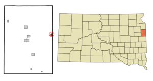
mapsize = 250px
map_caption = Location in Deuel County and the state ofSouth Dakota
mapsize1 =
map_caption1 =
image_dot_
dot_mapsize =
dot_map_caption =
dot_x =
dot_y =
pushpin_
pushpin_label_position =
pushpin_map_caption =
pushpin_mapsize =
subdivision_type = Country
subdivision_name =United States
subdivision_type1 = State
subdivision_name1 =South Dakota
subdivision_type2 = County
subdivision_name2 = Deuel
subdivision_type3 =
subdivision_name3 =
subdivision_type4 =
subdivision_name4 =
government_footnotes =
government_type =
leader_title =
leader_name =
leader_title1 =
leader_name1 =
leader_title2 =
leader_name2 =
leader_title3 =
leader_name3 =
leader_title4 =
leader_name4 =
established_title =
established_date =
established_title2 =
established_date2 =
established_title3 =
established_date3 =
area_magnitude =
unit_pref = Imperial
area_footnotes =
area_total_km2 = 1.8
area_land_km2 = 1.8
area_water_km2 = 0
area_total_sq_mi = 0.7
area_land_sq_mi = 0.7
area_water_sq_mi = 0
area_water_percent =
area_urban_km2 =
area_urban_sq_mi =
area_metro_km2 =
area_metro_sq_mi =
area_blank1_title =
area_blank1_km2 =
area_blank1_sq_mi =
population_as_of = 2000
population_footnotes =
population_note =
population_total = 231
population_density_km2 = 128.3
population_density_sq_mi = 330
population_metro =
population_density_metro_km2 =
population_density_metro_sq_mi =
population_urban =
population_density_urban_km2 =
population_density_urban_sq_mi =
population_blank1_title =
population_blank1 =
population_density_blank1_km2 =
population_density_blank1_sq_mi =
timezone = Central (CST)
utc_offset = -6
timezone_DST = CDT
utc_offset_DST = -5
latd = 44 |latm = 47 |lats = 35 |latNS = N
longd = 96 |longm = 27 |longs = 27 |longEW = W
elevation_footnotes =
elevation_m = 447
elevation_ft = 1467
postal_code_type =ZIP code
postal_code = 57237
area_code = 605
blank_name = FIPS code
blank_info = 46-23860GR|2
blank1_name = GNIS feature ID
blank1_info = 1265643GR|3
website =
footnotes =Gary is a city in Deuel County,
South Dakota ,United States . The population was 231 at the 2000 census.Geography
Gary is located at coor dms|44|47|35|N|96|27|27|W|city (44.793178, -96.457569)GR|1.
According to the
United States Census Bureau , the city has a total area of 0.7square mile s (1.8km² ), all of it land. The West Branch of theLac qui Parle River flows through the city as an intermittent stream near its headwaters. [cite book| title= South Dakota Atlas & Gazetteer |year=2001 |publisher=DeLorme |location=Yarmouth, Me. |isbn= 0-89933-330-3 |pages= p. 35]Gary has been assigned the
ZIP code 57237 and theFIPS place code 23860.Demographics
As of the
census GR|2 of 2000, there were 231 people, 128 households, and 62 families residing in the city. Thepopulation density was 334.5 people per square mile (129.3/km²). There were 148 housing units at an average density of 214.3/sq mi (82.8/km²). The racial makeup of the city was 99.57% White and 0.43% Native American.There were 128 households out of which 16.4% had children under the age of 18 living with them, 43.0% were married couples living together, 4.7% had a female householder with no husband present, and 50.8% were non-families. 50.0% of all households were made up of individuals and 31.3% had someone living alone who was 65 years of age or older. The average household size was 1.80 and the average family size was 2.62.
In the city the population was spread out with 16.5% under the age of 18, 3.5% from 18 to 24, 21.6% from 25 to 44, 26.0% from 45 to 64, and 32.5% who were 65 years of age or older. The median age was 52 years. For every 100 females there were 90.9 males. For every 100 females age 18 and over, there were 89.2 males.
The median income for a household in the city was $20,962, and the median income for a family was $31,250. Males had a median income of $19,500 versus $16,563 for females. The
per capita income for the city was $13,480. About 12.9% of families and 13.9% of the population were below thepoverty line , including 14.6% of those under the age of eighteen and 24.3% of those sixty five or over.References
External links
Wikimedia Foundation. 2010.