- Bushnell, South Dakota
Infobox Settlement
official_name = Bushnell, South Dakota
other_name =
native_name =
nickname =
settlement_type =Town
motto =
imagesize =
image_caption =
flag_size =
image_
seal_size =
image_shield =
shield_size =
image_blank_emblem =
blank_emblem_type =
blank_emblem_size =
imagesize =
image_caption =
flag_size =
image_
seal_size =
image_shield =
shield_size =
image_blank_emblem =
blank_emblem_type =
blank_emblem_size =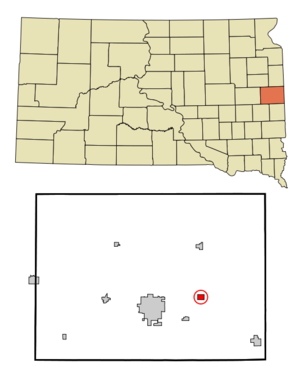
mapsize = 250px
map_caption = Location in Brookings County and the state ofSouth Dakota
mapsize1 =
map_caption1 =
image_dot_
dot_mapsize =
dot_map_caption =
dot_x =
dot_y =
pushpin_
pushpin_label_position =
pushpin_map_caption =
pushpin_mapsize =
subdivision_type = Country
subdivision_name =United States
subdivision_type1 = State
subdivision_name1 =South Dakota
subdivision_type2 = County
subdivision_name2 = Brookings
subdivision_type3 =
subdivision_name3 =
subdivision_type4 =
subdivision_name4 =
government_footnotes =
government_type =
leader_title =
leader_name =
leader_title1 =
leader_name1 =
leader_title2 =
leader_name2 =
leader_title3 =
leader_name3 =
leader_title4 =
leader_name4 =
established_title =
established_date =
established_title2 =
established_date2 =
established_title3 =
established_date3 =
area_magnitude =
unit_pref = Imperial
area_footnotes =
area_total_km2 = 1.8
area_land_km2 = 1.8
area_water_km2 = 0
area_total_sq_mi = 0.7
area_land_sq_mi = 0.7
area_water_sq_mi = 0
area_water_percent =
area_urban_km2 =
area_urban_sq_mi =
area_metro_km2 =
area_metro_sq_mi =
area_blank1_title =
area_blank1_km2 =
area_blank1_sq_mi =
population_as_of = 2000
population_footnotes =
population_note =
population_total = 75
population_density_km2 = 41.7
population_density_sq_mi = 107.1
population_metro =
population_density_metro_km2 =
population_density_metro_sq_mi =
population_urban =
population_density_urban_km2 =
population_density_urban_sq_mi =
population_blank1_title =
population_blank1 =
population_density_blank1_km2 =
population_density_blank1_sq_mi =
timezone = Central (CST)
utc_offset = -6
timezone_DST = CDT
utc_offset_DST = -5
latd = 44 |latm = 19 |lats = 38 |latNS = N
longd = 96 |longm = 38 |longs = 42 |longEW = W
elevation_footnotes =
elevation_m = 515
elevation_ft = 1690
postal_code_type =ZIP code
postal_code = 57276
area_code = 605
blank_name = FIPS code
blank_info = 46-08820GR|2
blank1_name = GNIS feature ID
blank1_info = 1254173GR|3
website =
footnotes =Bushnell is a town in Brookings County,
South Dakota ,United States . The population was 75 at the 2000 census.History
Bushnell was founded in 1904 and named for Frank E. Bushnell owner of the land on which the train depot was erected (the community was already built before but didn't have a name). Beginning as a farm town, Bushnell grew to encompass a railroad depot, cheese factory, and grain elevator at one point. In 1881 South Dakota College was founded in nearby Brookings, and Bushnell's economy began to decline as the population shifted to the new college town. By the 20th century however, Bushnell had found a new niche as an artist's community. With more than 30 percent of its citizens employed as artists, the tiny town of Bushnell has a greater percentage of artists in their workforce than does
Paris .Geography
Bushnell is located at coor dms|44|19|38|N|96|38|42|W|city (44.327310, -96.644935)GR|1.
According to the
United States Census Bureau , the town has a total area of 0.7square mile s (1.8km² ), all of it land.Demographics
As of the
census GR|2 of 2000, there were 75 people, 32 households, and 20 families residing in the town. Thepopulation density was 105.6 people per square mile (40.8/km²). There were 34 housing units at an average density of 47.9/sq mi (18.5/km²). The racial makeup of the town was 82.67% White, 12.00% Native American, 1.33% Asian, and 4.00% from two or more races. Hispanic or Latino of any race were 1.33% of the population.There were 32 households out of which 28.1% had children under the age of 18 living with them, 59.4% were married couples living together, 3.1% had a female householder with no husband present, and 34.4% were non-families. 34.4% of all households were made up of individuals and 6.3% had someone living alone who was 65 years of age or older. The average household size was 2.34 and the average family size was 2.95.
In the town the population was spread out with 25.3% under the age of 18, 6.7% from 18 to 24, 34.7% from 25 to 44, 25.3% from 45 to 64, and 8.0% who were 65 years of age or older. The median age was 35 years. For every 100 females there were 114.3 males. For every 100 females age 18 and over, there were 115.4 males.
The median income for a household in the town was $45,625, and the median income for a family was $50,833. Males had a median income of $28,333 versus $24,375 for females. The
per capita income for the town was $15,619. There were no families and 8.7% of the population living below thepoverty line , including no under eighteens and none of those over 64.References
External links
Wikimedia Foundation. 2010.