- Ward Township, Pennsylvania
Infobox Settlement
official_name = Ward Township, Pennsylvania
other_name =
native_name =
nickname =
settlement_type = Township
motto =
imagesize =
image_caption =
flag_size =
image_
seal_size =
image_shield =
shield_size =
image_blank_emblem =
blank_emblem_size =
mapsize = 250x200px
map_caption = Map of Tioga County Highlighting Ward Township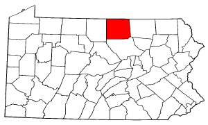
mapsize1 = 250x200px
map_caption1 = Map of Pennsylvania higlighting Tioga County
subdivision_type = Country
subdivision_name =United States
subdivision_type1 = State
subdivision_name1 =Pennsylvania
subdivision_type2 = County
subdivision_name2 = Tioga
subdivision_type3 =
subdivision_name3 =
subdivision_type4 =
subdivision_name4 =
government_footnotes =
government_type =
leader_title =
leader_name =
leader_title1 =
leader_name1 =
leader_title2 =
leader_name2 =
leader_title3 =
leader_name3 =
leader_title4 =
leader_name4 =
established_title = Settled
established_date = 1837
established_title2 = Incorporated
established_date2 = 1852
area_magnitude =
unit_pref = Imperial
area_footnotes =
area_total_km2 = 88.6
area_land_km2 =
area_water_km2 =
area_total_sq_mi = 34.2
area_land_sq_mi =
area_water_sq_mi =
area_water_percent =
area_urban_km2 =
area_urban_sq_mi =
area_metro_km2 =
area_metro_sq_mi =
area_blank1_title =
area_blank1_km2 =
area_blank1_sq_mi =
population_as_of = 2000
population_footnotes =
population_note =
population_total = 128
population_density_km2 = 1.4
population_density_sq_mi = 3.7
population_metro =
population_density_metro_km2 =
population_density_metro_sq_mi =
population_urban =
population_density_urban_km2 =
population_density_urban_sq_mi =
population_blank1_title =
population_blank1 =
population_density_blank1_km2 =
population_density_blank1_sq_mi =
timezone = Eastern Time Zone (North America)
utc_offset =
timezone_DST = EDT
utc_offset_DST =
latd =
latm =
lats =
latNS =
longd =
longm =
longs =
longEW =
elevation_footnotes =
elevation_m =
elevation_ft =
postal_code_type =
postal_code =
area_code =
blank_name =
blank_info =
blank1_name =
blank1_info =
website =
footnotes =Ward Township is a township in Tioga County,
Pennsylvania ,United States . The population was 128 at the 2000 census.Geography
According to the
United States Census Bureau , the township has a total area of 34.2square mile s (88.6km² ), of which, 34.2 square miles (88.6 km²) of it is land and 0.03% is water.Ward Township is bordered by Sullivan Township to the north, Bradford County to the east, Union Township, to the south and Hamilton and Covington Townships to the west.
Demographics
As of the
census GR|2 of 2000, there were 128 people, 60 households, and 36 families residing in the township. Thepopulation density was 3.7 people per square mile (1.4/km²). There were 220 housing units at an average density of 6.4/sq mi (2.5/km²). The racial makeup of the township was 100.00% White.There were 60 households out of which 16.7% had children under the age of 18 living with them, 55.0% were married couples living together, and 40.0% were non-families. 33.3% of all households were made up of individuals and 16.7% had someone living alone who was 65 years of age or older. The average household size was 2.13 and the average family size was 2.61.
In the township the population was spread out with 18.8% under the age of 18, 2.3% from 18 to 24, 25.0% from 25 to 44, 32.0% from 45 to 64, and 21.9% who were 65 years of age or older. The median age was 48 years. For every 100 females there were 106.5 males. For every 100 females age 18 and over, there were 121.3 males.
The median income for a household in the township was $27,500, and the median income for a family was $36,750. Males had a median income of $29,643 versus $18,958 for females. The
per capita income for the township was $15,553. There were 12.2% of families and 15.6% of the population living below thepoverty line , including no under eighteens and 33.3% of those over 64.References

Wikimedia Foundation. 2010.