- Middleton Field
-
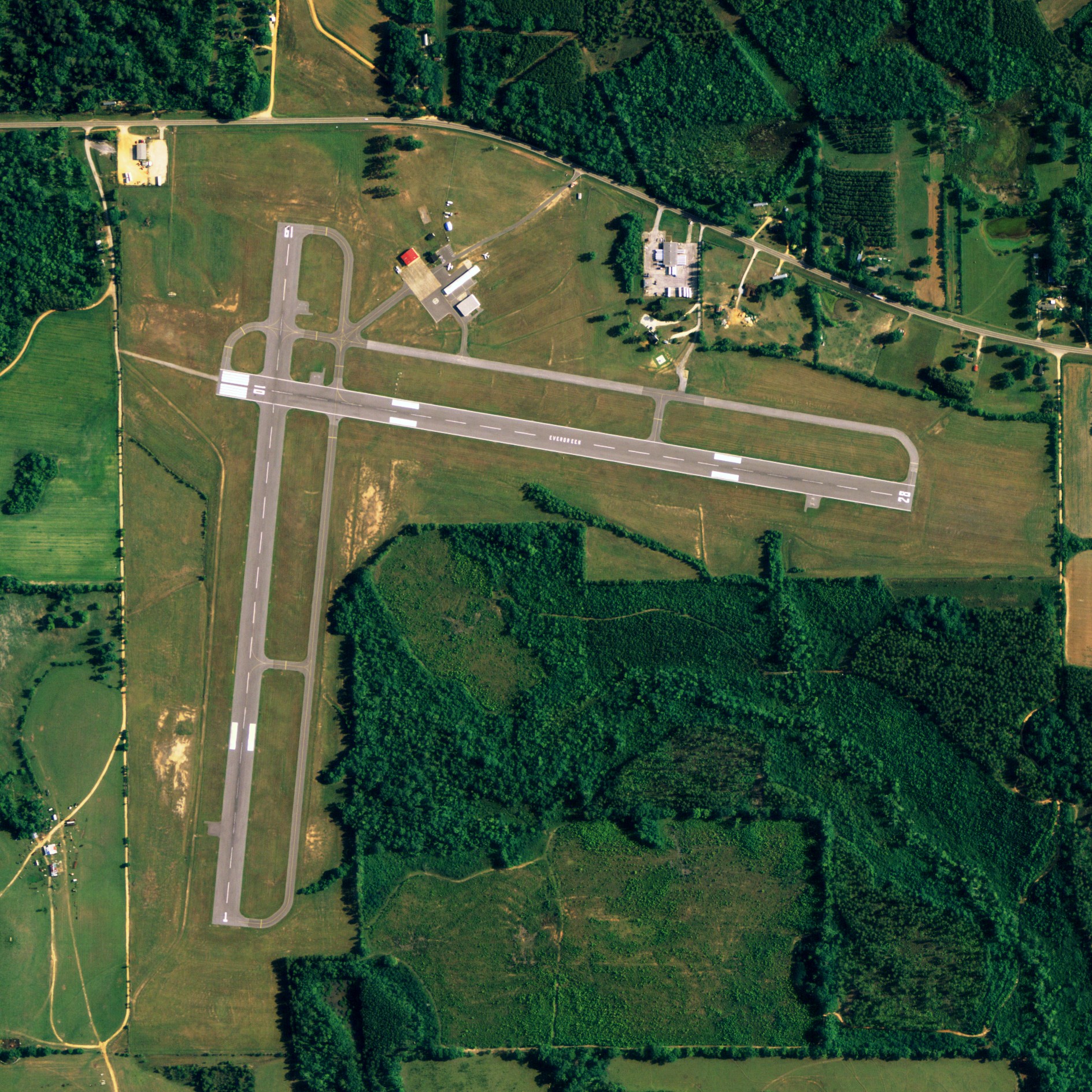
Middleton Field 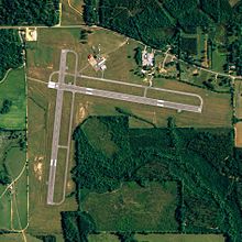
NAIP aerial image, 30 June 2006 IATA: none – ICAO: KGZH – FAA LID: GZH Summary Airport type Public / Military Owner City of Evergreen Serves Evergreen, Alabama Elevation AMSL 259 ft / 79 m Coordinates 31°24′57″N 087°02′39″W / 31.41583°N 87.04417°W Runways Direction Length Surface ft m 1/19 4,000 1,219 Asphalt 10/28 4,000 1,219 Asphalt Statistics (2007) Aircraft operations 134,005 Source: Federal Aviation Administration[1] Middleton Field (ICAO: KGZH, FAA LID: GZH, formerly 39J) is a public-use airport located 5 nautical miles (9.3 km; 5.8 mi) west of the central business district of Evergreen, a city in Conecuh County, Alabama, United States.[1] According to the FAA's National Plan of Integrated Airport Systems for 2009–2013, it is categorized as a general aviation facility.[2] Although the airport is owned by the City of Evergreen, it is primarily used for flight training by the U.S Navy.
Although most U.S. airports use the same three-letter location identifier for the FAA and IATA, Middleton Field is assigned GZH by the FAA but has no designation from the IATA.[3]
Contents
Facilities and aircraft
Middleton Field covers an area of 200 acres (81 ha) which contains two asphalt paved runways (1/19 and 10/28) each measuring 4,000 x 150 ft (1,219 x 46 m). For the 12-month period ending June 25, 2007, the airport had 134,005 aircraft operations, an average of 367 per day: 96% military and 4% general aviation.[1]
Accidents
On July 13, 1982, Lt. Cmdr. Barbara Allen Rainey, the U.S. Navy's first female pilot, and her student were killed in a crash while practicing touch-and-go landings at Middleton Field.[4]
References
- ^ a b c FAA Airport Master Record for GZH (Form 5010 PDF), effective 2007-12-20
- ^ National Plan of Integrated Airport Systems for 2009–2013: Appendix A: Part 1 (PDF, 1.33 MB). Federal Aviation Administration. Updated 15 October 2008.
- ^ Great Circle Mapper: KGZH - Evergreen, Alabama (Middleton Field)
- ^ Arlington Cemetery Biography for Lt. Cmdr. Barbara Allen Rainey
External links
- Airfield photos for GZH from Civil Air Patrol
- FAA Terminal Procedures for GZH, effective 20 October 2011
- Resources for this airport:
- AirNav airport information for KGZH
- FlightAware airport information and live flight tracker
- NOAA/NWS latest weather observations
- SkyVector aeronautical chart, Terminal Procedures for KGZH
Categories:- Airports in Alabama
- Buildings and structures in Conecuh County, Alabama
- Transportation in Conecuh County, Alabama
Wikimedia Foundation. 2010.