- Obando, Bulacan
-
Obando — Municipality — 
SealMap of Bulacan showing the location of Obando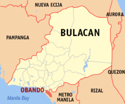 Location in the Philippines
 Obando
Coordinates: 14°42′N 120°55′E / 14.7°N 120.917°ECoordinates: 14°42′N 120°55′E / 14.7°N 120.917°E Country  Philippines
Region Central Luzon (Region III) Province Bulacan District 4th District Founded 1753 Barangays 11 Government – Mayor Orencio E. Gabriel (Liberal/Partido Del Pilar) Area – Municipality 52.1 km2 (20.1 sq mi) Population (2007) – Municipality 56,258 – Density 1,079.8/km2 (2,796.7/sq mi) – Metro Manila Time zone PST (UTC+8) ZIP code 3021 Income class 2nd class Website elgu2.ncc.gov.ph/obando/ Population Census of Obando Census Pop. Rate 1995 51,488 — 2000 52,906 0.58% 2007 56,258 0.85% Obando[1] is a 2nd class municipality in the province of Bulacan, Philippines. It is 16 kilometers away from the Philippine capital Manila. Obando is landlocked, bordered by two cities from Metro Manila namely Valenzuela City in the east, Navotas and Malabon City in the south, Bulacan in the north, and the waters of Manila Bay in the west. According to the latest census, it has a population of 56,258 inhabitants in 11,229 households.
Contents
Built up area
With the continuous expansion of Metro Manila, the city is now included in Manila built up area which reaches San Ildefonso in its Northernmost part.[1]
Demographics
As of 2002, Obando has an estimated population of 58,245 wherein 49% are male and 51% are female. Of the current population, about 14% live in rural barangays while the rest constitute the urban population. There are 12,349 households. The average monthly income of a household is P9,000.00, slightly below the P9,540.00 minimum for a family of 6 threshold set by Department of Social Welfare and Development.[1]
Problems
- Heavy flooding during rainy seasons
- River pollution caused by the Tanza, Navotas dumpsite. In 2002, under the leadership of Mayor Nesty Joaquin, the Sangguniang Bayan of Obando, Bulacan passed a controversial resolution allowing all the Phileco (Philippine Ecology Systems Corp.) barges that contains tons of Metro Manila's garbage to pass the river of Obando and dumped it in a river-turned "controlled" dumpsite facility in Tanza, Navotas which is only 1 km away from Obando. Mass actions followed but local officials failed to stop the dumping up to this date. Studies showed that the operation of the dump was polluting the river and had caused several diseases among residents, mostly old folks, women and children.
- Obando Landfill. Environment Secretary Ramon J.P. Paje has been asked to revoke the environmental compliance certificate his department issued to a landfill project for aggravating the situation in Obando town of Bulacan. Coalition president Roy Alvarez warned Paje the flooding in Obando is proof that the fishing town is a flood-prone area and the construction of a sanitary landfill is a blunder. The threat of extreme weather disturbances due to climate change and constructing a landfill in a flood disaster hotspot like Obando, Alvarez said. Citizens’ groups, religious associations, an environmental health coalition and a fisherfolk alliance, had asked Paje to stop the construction of the 44-hectare landfill in Barangay Salambao in Obando. They cited the proximity of the waste disposal facility to Obando River and Manila Bay. The protesters said that the Obando landfill project is illegal and violative of the Ecological Solid Waste Management Act. They expressed belief the landfill will prejudice the health of Obando River and its people, worsen the decades-old flooding problem in the town, contribute to the deterioration of Manila Bay and destroy the livelihood of tens of thousands of people.
- Jueteng. The rampant and widespread proliferation of Jueteng (an illegal numbers game) being tolerated by authorities.
- Corrupt Officials
Geography
Flat and low-lying coastal plains characterize the general topography of Obando. The area was formerly an estuary, but it filled up partially from the peripheral parts of each sand bar and sand spit and formed up into current figure that mainly consisted of commercial district, partly industrial district, residential area and fishpond. Within the municipality are two rivers and three creeks namely Meycauayan River, in the north, Pinagkabalian River, in the south and Paco Creek, Hulo Creek and Pag-asa Creek traversing the town parallel to the provincial road.[1]
Obando has a land area of 52.1 km². It has an urban area which comprise 2 barangays, the other 9 barangays of rural area of the abovecited area, 82.50% are fishponds. Obando is politically subdivided into 11 barangays (8 urban, 3 rural). Barangays Binuangan and Salambao are located along the Paliwas River, and can only be reached by means of motorized boats.[1]
- Panghulo
- Catanghalan
- Pag-asa
- Paliwas
- San Pascual
- Hulo
- Lawa
- Paco
- Tawiran
- Binuangan
- Salambao
Obando, just like the other towns of Bulacan, has two pronounced seasons: dry and wet season. The wet season is from May to October and the dry season is from November to April. The rainfall of the wet season accounts for about 80% of the annual rainfall, which is due to west monsoons and typhoons.[1]
History
In the 18th century, the municipalities now known as Meycauayan, Polo and Obando comprised only one town, the Municipality of Meycauayan. The town of Polo and Obando, formed a barrio called Catangalan. In the year 1623, the municipality of Polo, now called Valenzuela City was organized which included the present-day territories of the Town of Obando. By virtue of a decree promulgated during the time of Governor and Captain General of the Archipelago, Francisco Jose de Obando y Solis, the town was created and separated from its mother town Polo on May 14, 1753. In the Governor's untimely death at the hands of the British during the Seven Year's War, the creation and establishment of the town was made and attended by the Alcalde Mayor of the province, Don Francisco Morales y Mozabe, the Provincial Minister, S. Gregorio, Rev. Fr. Alejandro Ferrer, together with numerous religious devotees. The minister who was chosen to administer the town was Rev. Fr. Manuel De Olivendia. In the year 1907, Obando was made an independent town of Bulacan. Then through the untiring efforts of the municipal officials, a portion of Gasak, Navotas was reclaimed to form a part of Obando. The municipal officials, believing that this portion was once a part of the municipality but was adopted by Navotas in the course of time, effortlessly pushed through its claim to regain the area. The concerted action of all those concerned paid off when on January 30, 1975, by virtue of a Presidential Decree No. 646, a portion of approximately 1.78 square kilometers of Gasak, Navotas was returned to Obando. This is mostly fishpond and sandy beach and believed that when fully developed, this will serve as a good tourist attraction. By resolution of 1975 Municipal Council, the area was made into a barangay and named it Nuestra Señora de Salambao in honor of one of its patron saints.[1]
Mayors Of Obando, Bulacan
Orencio Gabriel (2007–Present)
Zoilito Santiago (2004–2007)
Onesimo Joaquin (2001–2004)
Conrado Lumabas Jr. (1992–2001)
Bienvenido Evangelista (1988–2001)
Antonio Joaquin (OIC 1986 - 1988)
- Other names to follow -
Vice Mayors Of Obando, BulacanDanilo de Ocampo (2010–Present)
Leonardo Pantanilla (2007–2010)
Jose Correa (2004–2007)
Zoilito Santiago (2001–2004)
Onesimo Joaquin (1998–2001)
Romerico Santos (1995–1998)
Gaudioso Espinosa (1992–1995)
Remigio Dela Cruz (1988–1992)
- Other names to follow -See also
References
External links
- OBANDENYO.COM
- elgu2.ncc.gov.ph
- Philippine Standard Geographic Code
- 2000 Philippine Census Information
- 2000 Philippine Census Information
- Alvin Claridades' Bahay Pahina
- gmanews.tv/video, Bulacan electrical shop fire placed under control after 24 hours, 23 January 2008 (in Filipino)
- Abs-Cbn Interactive, Obando factory blaze not yet declared 'fire out'
Municipalities Component cities - Malolos
- Meycauayan
- City of San Jose del Monte
Categories:- Municipalities of Bulacan


Wikimedia Foundation. 2010.