Montbizot

Montbizot

Montbizot

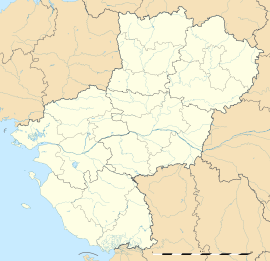
Montbizot is located in France
{{{alt}}}
Montbizot
Administration
Country France
Region Pays de la Loire
Department Sarthe
Arrondissement Le Mans
Canton Ballon
Intercommunality Communauté de communes des Portes du Maine
Mayor Alain Besnier
(2008–2014)
Statistics
Elevation 49–91 m (161–299 ft)
Land area1 11.38 km2 (4.39 sq mi)
Population2 1,528  (2006 [1])
 - Density 134 /km2 (350 /sq mi)
INSEE/Postal code 72205/ 72380
1 French Land Register data, which excludes lakes, ponds, glaciers > 1 km² (0.386 sq mi or 247 acres) and river estuaries.
2 Population without double counting: residents of multiple communes (e.g., students and military personnel) only counted once.

Coordinates: 48°08′52″N 0°11′01″E / 48.1477777778°N 0.183611111111°E / 48.1477777778; 0.183611111111

Montbizot is a commune in the Sarthe department in the region of Pays-de-la-Loire in north-western France.

See also

References

  1. ^ http://www.insee.fr/fr/ppp/bases-de-donnees/recensement/populations-legales/departement.asp?dep=72#dep_B Populations légales 2006 publiées par l’INSEE le 1er janvier 2009


Wikimedia Foundation. 2010.

Игры ⚽ Нужно решить контрольную?

Look at other dictionaries:

  • Montbizot — País …   Wikipedia Español

  • Montbizot — 48° 08′ 52″ N 0° 11′ 01″ E / 48.1477777778, 0.183611111111 …   Wikipédia en Français

  • Montbizot — Original name in latin Montbizot Name in other language Montbizot State code FR Continent/City Europe/Paris longitude 48.14995 latitude 0.18384 altitude 64 Population 1208 Date 2012 01 18 …   Cities with a population over 1000 database

  • Gare de Montbizot — Montbizot Localisation Pays France Commune Montbizot Adresse Rue Paillard Dulcéré 72380 Montbizot Coordonnées géographiques …   Wikipédia en Français

  • Orne saosnoise — Pour les articles homonymes, voir Orne. l Orne saosnoise ou l Orne saônoise Caractéristiques Longueur …   Wikipédia en Français

  • Ballon (Sarthe) — Pour les articles homonymes, voir Ballon. 48° 10′ 36″ N 0° 14′ 09″ E …   Wikipédia en Français

  • Gare de Teillé — Teillé Localisation Pays France Commune Teillé Adresse 72380 Teillé Coordonnées géographiques …   Wikipédia en Français

  • Saint-Ouen-sous-Ballon — Ballon (Sarthe) Pour les articles homonymes, voir Ballon. Ballon Administration Pays France Région Pays de la Loire Département …   Wikipédia en Français

  • Chevaigné (Sarthe) — Saint Jean d Assé Saint Jean d Assé Administration Pays France Région Pays de la Loire Département Sarthe Arrondissement Le Mans Canton …   Wikipédia en Français

  • La Guierche — 48° 06′ 53″ N 0° 11′ 43″ E / 48.1147222222, 0.195277777778 …   Wikipédia en Français

Share the article and excerpts

Direct link
Do a right-click on the link above
and select “Copy Link”