Cross Mountain (Pennsylvania)

Cross Mountain (Pennsylvania)
Cross Mountain

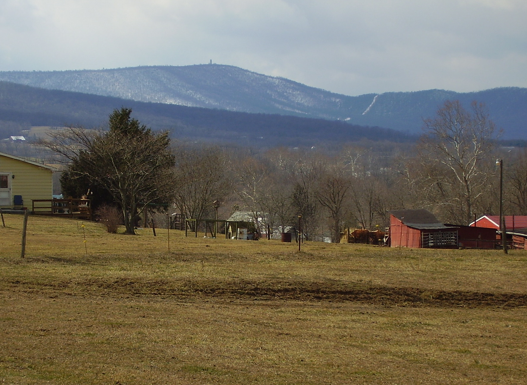
Cross Mountain (note the tower on the summit)
Elevation 2,062 ft (628 m)
Location
Location Franklin County, Pennsylvania, USA
Range Appalachian Mountains
Topo map USGS Clear Spring (MD, PA) Quadrangle

Cross Mountain is the highest peak in the Bear Pond Mountains, a sub range of the Appalachian Mountains. This grouping of mountains straddle the Maryland and Pennsylvania border.

Cross Mountain and Hearthstone Mountain 2,021 feet (616 m) which is on the Maryland side, form a unique geologic formation known as the "Punchbowl". This feature was created by the weathered shales of the Ordovician age in the center of a south-plunging anticline, having been eroded to expose a large amphitheater like feature (punchbowl). Cross and Hearthstone Mountain are made of hard resistant quartzite of the Tuscarora Formation of the Silurian age.

Cross Mountain is also the site of a deactivated microwave relay station, that was used during the Cold War. The unit was encased in a 103 ft. tower, and known as the "Cannonball" site 2. The site was closed in 1977. Access to the summit is still restricted.

References

Alan R. Geyer (1979) "Outstanding Geologic Features of Pennsylvania", Geological Survey of Pennsylvania

Albert LaFrance, Secret Cold War Landscape, Presidential Emergency Facilities Microwave Radio Relay Station Site 2 - "Cannonball" atop Cross Mountain, near Shimpstown, PA., Cold War webring, last update June 12, 1999.

Coordinates: 39°43′42″N 77°59′30″W / 39.72829°N 77.99176°W / 39.72829; -77.99176


Wikimedia Foundation. 2010.

Игры ⚽ Нужно решить контрольную?

Look at other dictionaries:

  • Cross Mountain — may refer to: Cross Mountain (Arizona) Cross Mountain (California) Cross Mountain (Colorado) Cross Mountain (Montana) Cross Mountain (Pennsylvania) Cross Mountain (Tennessee), site of the Cross Mountain Mine disaster Cross Mountain, Texas This… …   Wikipedia

  • Cross Roads, Pennsylvania —   Borough   …   Wikipedia

  • Pennsylvania 500 — NASCAR race infobox Name=Sunoco Presents The American Red Cross Pennsylvania 500 Logo=PENN500 Logo sm 2008.png Img size=120px Venue=Pocono Raceway Sponsor=Sunoco, American Red Cross First race=1974 Distance=convert|500|mi|km|1 Laps=200 Previous… …   Wikipedia

  • Cross Fork — For the community named Cross Fork, see Cross Fork, Pennsylvania. Cross Fork is a 14.4 mile long (23.2 km)[1] tributary of Kettle Creek in Potter County, Pennsylvania, in the United States. Cross Fork joins Kettle Creek at the village of… …   Wikipedia

  • Mountain View School District (Pennsylvania) — Mountain View School District Address RR # 1 Box 339A 11748 State Route 106 Kingsley, Pennsylvania …   Wikipedia

  • Mountain Creek (Yellow Breeches Creek) — Mountain Creek is a 20.9 mile long (33.6 km)[1] tributary of Yellow Breeches Creek in Cumberland County, Pennsylvania in the United States. Mountain Creek joins Yellow Breeches Creek near the borough of Mount Holly Springs. Tributaries… …   Wikipedia

  • Mountain Ridge High School (Frostburg, Maryland) — Mountain Ridge High School is a high school in Frostburg, Maryland, that houses over 1000 students from the Georges Creek Valley, the Greater Frostburg vicinity, and the Westernport region. The school mascot is a miner and the school colors are… …   Wikipedia

  • Mountain State University — Established 1933 Type Private University President Charles H. Polk Academic staff …   Wikipedia

  • Pennsylvania Turnpike — This article is about the east west mainline and Northeast Extension of the Pennsylvania Turnpike system, commonly referred to simply as the Pennsylvania Turnpike. For the agency overseeing the Pennsylvania Turnpike system, see Pennsylvania… …   Wikipedia

  • Pennsylvania Route 309 — PA 22 redirects here. PA 22 may also refer to Pennsylvania s 22nd congressional district. PA Route 309 Major highways in eastern Pennsylvania with PA 309 in red …   Wikipedia

Share the article and excerpts

Direct link
Do a right-click on the link above
and select “Copy Link”