- Piz Corvatsch
-
Piz Corvatsch
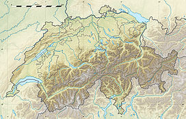
Piz Corvatsch seen from the Corvatsch stationElevation 3,451 m (11,322 ft) Prominence 383 m (1,257 ft) [1] Parent peak Piz Bernina Translation Crow (or raven) peak Location Graubünden,  Switzerland
Range Bernina Range Coordinates 46°24′30″N 9°48′58″E / 46.40833°N 9.81611°ECoordinates: 46°24′30″N 9°48′58″E / 46.40833°N 9.81611°E Climbing First ascent 1850 by Johann Coaz and party Easiest route From the Corvatsch station Piz Corvatsch (3,451 m (11,322 ft)) is a mountain in the Bernina Range in Switzerland. A minor summit, Piz Murtel (3,304 m (10,840 ft)), lies just above the cable car station (the cable car leaves from Silvaplana).
Weather
Climate data for Piz Corvatsch Month Jan Feb Mar Apr May Jun Jul Aug Sep Oct Nov Dec Year Average high °C (°F) −9.2
(15.4)−9.9
(14.2)−8.9
(16.0)−6.8
(19.8)−2.7
(27.1)0.5
(32.9)3.4
(38.1)3.8
(38.8)1.9
(35.4)−1
(30)−5.9
(21.4)−8.3
(17.1)−3.6 Daily mean °C (°F) −12.4
(9.7)−12.7
(9.1)−11.5
(11.3)−8.8
(16.2)−4.5
(23.9)−1.4
(29.5)1.3
(34.3)1.3
(34.3)−0.5
(31.1)−3.4
(25.9)−8.7
(16.3)−11.1
(12.0)−6 Average low °C (°F) −14.9
(5.2)−15.1
(4.8)−14.2
(6.4)−11.3
(11.7)−7
(19)−3.8
(25.2)−1.2
(29.8)−1.1
(30.0)−2.8
(27.0)−5.5
(22.1)−10.9
(12.4)−13.7
(7.3)−8.5 Precipitation mm (inches) 47
(1.85)45
(1.77)57
(2.24)64
(2.52)92
(3.62)99
(3.9)90
(3.54)99
(3.9)83
(3.27)63
(2.48)66
(2.6)45
(1.77)850
(33.46)Avg. precipitation days 7.3 7.5 8.7 10.4 13.7 12.5 11.6 12.1 7.7 7.7 9 7.8 116 Source: MeteoSchweiz [2] External links
References
- ^ Swisstopo maps
- ^ "Temperature and Precipitation Average Values-Table, 1961-1990" (in German, French, Italian). Federal Office of Meteorology and Climatology MeteoSwiss. http://www.meteoswiss.admin.ch/web/de/klima/klima_schweiz/tabellen.html. Retrieved 8 May 2009.
- Collomb, Robin, Bernina Alps, Goring: West Col Productions, 1988
Categories:- Bernina Range
- Engadin
- Mountains of the Alps
- Alpine Three-thousanders
- Mountains of Switzerland
- Visitor attractions in Switzerland
- Cable cars in Switzerland
Wikimedia Foundation. 2010.


