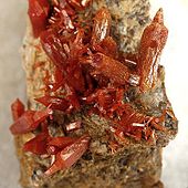
Cerbat Mountains

Cerbat Mountains
Cerbat Mountains
Range
Country United States
State Arizona
Highest point Mount Tipton
 - elevation 7,138 ft (2,176 m)
Vanadinite from the old Western Mine, in the southern Cerbat Mountains [1]

The Cerbat Mountains is a mountain range in northwest Arizona immediately north of Kingman.

It is a 23 mi long range trending slightly northwest-southeast. It lies directly east of the 130-mile long Black Mountains range and is separated by the Sacramento Valley bordering southwest of Kingman through which Interstate 40 turns south and west to meet Needles, California; the long Detrital Valley and plains drains northwest of the mountains into southern Lake Mead.

A series of peaks can be found towards the southern end of the range, including Packsaddle Mountain at 6,431 feet (1,960 m), and Cherum Peak at 6,983 feet (2,128 m).

The northern section of the Cerbat Mountains is composed mostly of the Mount Tipton Wilderness, with Mount Tipton being its peak at 7,148 feet (2,179 m). The Dolan Springs community is at the base of the wilderness on the northwestern side of the Cerbat Mountains

References

See also

Coordinates: 35°25′52″N 114°10′04″W / 35.4311041°N 114.1677334°W / 35.4311041; -114.1677334


Wikimedia Foundation. 2010.

Игры ⚽ Поможем сделать НИР

Look at other dictionaries:

  • Cerbat Mountains — Sp Sèrbato kalna Ap Cerbat Mountains L JAV (Arizona) …   Pasaulio vietovardžiai. Internetinė duomenų bazė

  • Cerbat, Arizona —   Ghost Town   …   Wikipedia

  • Black Mountains (Arizona) — Geobox|Range name=Black Mountains image size= image caption= country=United States state=Arizona geology=|orogeny= highest=Mount Wilson highest elevation imperial=5445 map caption=The Black Mountains of Arizona are located in northwest Arizona… …   Wikipedia

  • Mount Tipton Wilderness — IUCN Category Ib (Wilderness Area) …   Wikipedia

  • Mount Tipton — Elevation 7,148 ft (2,179 m) Location Location …   Wikipedia

  • List of mountain ranges of Arizona — There are 194 named mountain ranges in Arizona. The extra items listed may include::Mingus Mountain, the high, NW section of the Black Hills:Shiprock:Sierra Madre Occidental (of W continental Mexico) The list*Agua Caliente Mountains ndash;Yuma… …   Wikipedia

  • List of mountain ranges of the Lower Colorado River Valley — This is a List of mountain ranges of the Lower Colorado River Valley, located in the western part of the southwestern United States; the eastern region would be the Rio Grande Valley of New Mexico, Texas, and northern Mexico.This doubled list has …   Wikipedia

  • List of Arizona Wilderness Areas — This is a List of Arizona Wilderness Areas. A second list contains the geographic landform that is most closely associated with it, or is in its proximity.Note: LCRV = Lower Colorado River Valley List of Arizona wilderness areas*Apache Creek… …   Wikipedia

  • List of LCRV Wilderness Areas (Colorado River) — This is a list of adjoining wilderness areas for the Lower Colorado River Valley . The List of Lower Colorado River Valley Wilderness Areas (Colorado River) is separated into the west side of the Colorado River: California Nevada ndash;and the… …   Wikipedia

  • Serbato kalnai — Sp Sèrbato kalna Ap Cerbat Mountains L JAV (Arizona) …   Pasaulio vietovardžiai. Internetinė duomenų bazė

Share the article and excerpts

Direct link
Do a right-click on the link above
and select “Copy Link”