- Dhoong
-
Dhoong
ڈھونگ— Village — Dhoong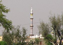 Location in Pakistan
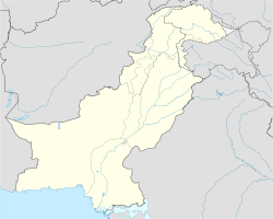
 Dhoong
Coordinates: 33°07′0″N 73°10′48.60″E / 33.116667°N 73.180167°E Country  Pakistan
Region Rawalpindi District Rawalpindi District Tehsil Gujar Khan Tehsil Union council Narali
Ethnicity Rajput, Gujjar, otherPopulation – Total 4,560 Time zone PST (UTC+5) Postal Code 47770 Area code(s) 051-3 Dhoong (Urdu: ڈھونگ), part of Narali Union Council, is the second largest village in Gujar Khan Tehsil, Rawalpindi District, Punjab, Pakistan . Dhoong is a historic village of Rawalpindi District and noted for its natural reserves of oil and natural gas.
Contents
Educational institutions
- Govt. Boys High School Dhoong
- Govt. Girls High School Dhoong
- Al-Hijra Islamic Secondary School Dhoong
- Dad Public School Dhoong
- jinnah modern School Dhoong
- Madrissa Touseef-Ul-Quran Dhoong
Hospitals
- Basic Health Unit Dhoong
Post Office
- Post Office Dhoong 47770, GPO Gujar Khan
Banks / Financial Institution
- Habib Bank Ltd Dhoong Branch
Telecommunication
The PTCL provides the main network of landline telephone. Many ISPs and all major mobile phone,Wireless companies operating in Pakistan provide service in Dhoong.
Languages
- Pothowari and Punjabi are the main languages of Dhoong, other languages are Urdu and English.
Other Villages Near Dhoong
- Tarati, Ahdi, Narali (Union Council), Daultala, Jatli (Police Station), Dhoke Adra, Dhoke Budhal, Dhoke Cheemian, Dhoke Kanyal, Dhoke Landian, Faryal, Fazolian, Kayal, Thakra Mohra, Mastala, (Dohda, Langah, Domali, Jand- Distt Chakwal)
Transport
- Dhoong is situated at Daultala – Mulhal Mughlan Road. Gujar Khan is about 18 kilometers, Rawalpindi - Islamabad is about 45 kilometers and Chakwal is about 26 kilometers from Dhoong. There are many ways to get around Dhoong which Includes public transport, Buses, Suzukis, Van, Cars, Taxis, Auto-rickshaws, Motor Cycles and Tractors.
Coordinates: 33°07′N 73°10′E / 33.117°N 73.167°E
Categories:- Villages in Gujar Khan
- Populated places in Rawalpindi District
- Rawalpindi District geography stubs


Wikimedia Foundation. 2010.