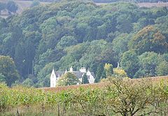
- Coberley
-
Coordinates: 51°51′14″N 2°02′28″W / 51.854°N 2.041°W
Coberley 
Seven Springs
 Coberley shown within Gloucestershire
Population 360 (2001 Census) OS grid reference SO9615 Parish Coberley District Cotswold[1] Shire county Gloucestershire Region South West Country England Sovereign state United Kingdom Post town Cheltenham Postcode district GL53 Dialling code 01242 Police Gloucestershire Fire Gloucestershire Ambulance Great Western EU Parliament South West England List of places: UK • England • Gloucestershire Coberley is a village and civil parish in the Cotswold District of Gloucestershire in England, 4 miles (6.4 km) south of Cheltenham.
The village is in a valley at the confluence of a number of streams that form the River Churn, a tributary of the River Thames. In medieval times the village was closer to the main road, near a spring to the east of Coberley Court. A short distance to the east are the sites of the mediaeval and modern villages of Upper Coberley.
Contents
History
The parish has two long barrows: one about 0.75 miles (1.21 km) west of the parish church and the other about 2 miles (3.2 km) west-northwest of the church.[2] A skeleton was discovered in the later barrow before 1779.[2]
The valley north of Coberley is the site of a Roman villa complex that has been the source of numerous archaeological finds, including coins, tiles, pottery and mosaics.[3] The site was excavated by Channel 4's Time Team in 2007 for an episode that was broadcast on 3 February 2008.[3]
The Church of England parish church of Saint Giles had Norman features until the architect John Middleton rebuilt it in 1869-72.[4] Middleton retained the Decorated Gothic south chapel, built in 1340 as a chantry to Saint Mary.[4] He retained also the Perpendicular Gothic bell tower.[4]
Dowmans Farm house was built in the 17th century.[5] The Rectory was designed by Richard Pace and built in 1826.[6] The village school was designed by David Brandon and built in 1857.[6] It is now Coberley Church of England Primary School.[7]
Byename/Surname
People have been labelled "de Coberley" or "of Coberley" since 1100, although early uses of the name were probably temporary descriptions rather than as an hereditary surname. It is not until the late 13th century that the name is likely to have been used by one, or several different, families as a surname. Uses of the name seem to have moved away from Coberley in the early 14th century, possibly to places such as Birlingham, Worcestershire and Devon, although no definite links have been found, and there are several places in Britain with a similar name. Over time the spelling of the name has mutated and possible variations include Coberley, Coberly, Cubberley, Cubberly, Cobleigh and Cobley.
References
- ^ "Neighbourhood Statistics: Full dataset view: Area selected: Cotswold (Non-Metropolitan District)". Office for National Statistics. http://www.neighbourhood.statistics.gov.uk/dissemination/viewFullDataset.do?instanceSelection=03070&productId=779&$ph=60_61&datasetInstanceId=3070&startColumn=1&numberOfColumns=8&containerAreaId=790398. Retrieved 21 January 2010.
- ^ a b Verey, 1970, page 192
- ^ a b "Coberley, Gloucestershire First screened 3 February 2008". TimeTeam. Channel 4. http://www.channel4.com/history/microsites/T/timeteam/2008/cheltenham/. Retrieved 30 May 2010.
- ^ a b c Verey, 1970, page 190
- ^ Verey, 1970, pages 191-192
- ^ a b Verey, 1970, page 191
- ^ Coberley C of E Primary School
Sources
- Verey, David (1970). The Buildings of England: Gloucestershire: The Cotswolds. Harmondsworth: Penguin Books. pp. 190–192. ISBN 0 14 071040 X.
External links
- Location map (Ordnance Survey)
- GENUKI: Coberley, Gloucestershire - UK genealogy page
- Coberly/Cubberley/Cobley/Cobleigh DNA Project
Categories:- Villages in Gloucestershire
- Cotswold (district)
Wikimedia Foundation. 2010.

