- Cornelly
-
Not to be confused with Cornelly, Cornwall.
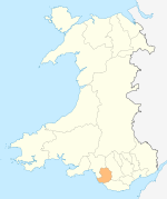
Cornelly (Welsh: Corneli) is a community in Bridgend County Borough, South Wales. In 2001, the population of the Cornelly ward was 5,982.[1]
The community includes two villages, North Cornelly and South Cornelly, and it is bisected by the A48 and M4. Sand dunes in the area conceal the walled town of Kenfig, founded in the 1120s and overwhelmed in the late 14th century.[2] Another notable local feature is Sker House, a historic building which overlooks the dunes.[2]
Notes
- ^ http://www.bridgend.gov.uk/web/groups/public/documents/about-bcbc/000804.hcsp
- ^ a b The Welsh Academy Encyclopedia of Wales. Cardiff: University of Wales Press 2008.
Bridgend County Borough Bridgend County Borough Council Communities Brackla · Bridgend · Cefn Cribwr · Coity · Coychurch Higher · Coychurch Lower · Cornelly · Garw Valley · Laleston · Llangynwyd Lower · Llangynwyd Middle · Maesteg · Merthyr Mawr · Newcastle Higher · Ogmore Vale · Pencoed · Porthcawl · Pyle · St Bride's Minor · Ynysawdre
Towns and villages Aberkenfig · Bettws · Blackmill · Bridgend · Bryncethin · Brynmenyn · Bryntirion · Caerau · Cefn Cross · Cornelly · Coychurch · Cwmfelin · Danygraig · Garth · Heol-y-Cyw · Kenfig · Kenfig Hill · Litchard · Llangan · Llangeinor · Llangwynydd · Llangynwyd · Maudlam · Maesteg · Merthyr Mawr · Nantymoel · Newton · North Cornelly · Nottage · Pantygog · Pantyrawel · Pen-y-Fai · Pencoed · Pontycymer · Porthcawl · Price Town · Pyle · Sarn · South Cornelly · Tondu · Tythegston · Wild Mill · WyndhamCastles Rivers Coordinates: 51°31′1″N 3°42′15″W / 51.51694°N 3.70417°W
Categories:- Villages in Bridgend county borough
- Glamorgan geography stubs
Wikimedia Foundation. 2010.
