- Monterey Bay Academy Airport
-
Monterey Bay Academy Airport 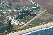
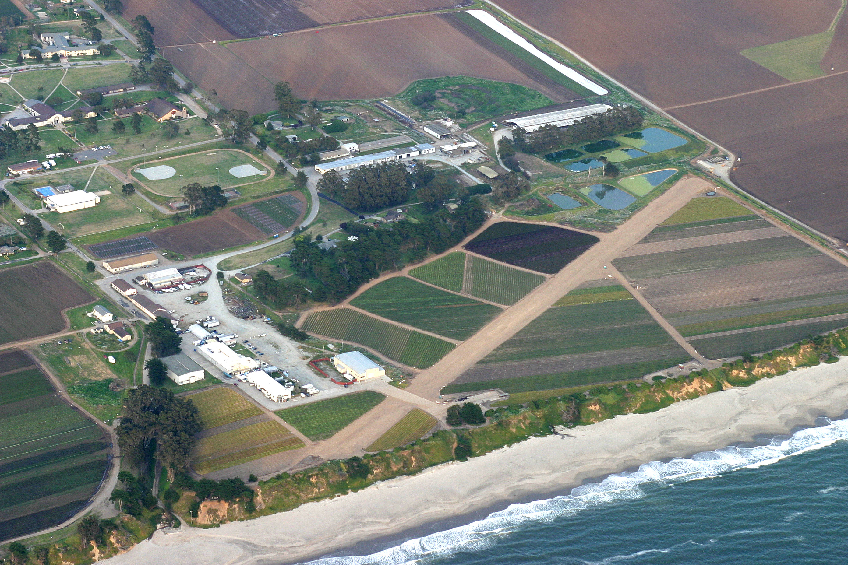
IATA: none – ICAO: none – FAA LID: CA66 Summary Airport type Private Operator Seventh-day Adventist Church Location Monterey Bay Academy Elevation AMSL 70 ft / 21 m Coordinates 36°54′22″N 121°50′35″W / 36.90611°N 121.84306°WCoordinates: 36°54′22″N 121°50′35″W / 36.90611°N 121.84306°W Runways Direction Length Surface ft m 10/28 2,200 671 Soil Monterey Bay Academy Airport (FAA LID: CA66) is located near the city of Watsonville in Santa Cruz County, California, USA. This private use airport is owned by the Seventh-day Adventist Church and located on the campus of the Monterey Bay Academy, site of the former Camp McQuaide.
History
In 1926, the 63rd coastal artillery regiment moved from Santa Cruz, California, to an area just east of the town of Capitola. Its camp was named for Major Joseph P. McQuaide, who was born in 1867 and graduated from Santa Clara University. He served as Chaplain of the California National Guard in the Spanish American War and World War I, and died March 29, 1924. By 1938, noise from target practice annoyed Capitola residents, so a more remote place was found.[1] 379 acres (1.53 km2) were purchased farther south, on coastal farmland near the town of Watsonville. The Works Progress Administration built San Andreas road to the new site.[2]
A small aircraft landing strip was built so airplanes could drop targets into the ocean. It became the training center of what was then the 250th artillery regiment. In September 1940, the regiment was called up to duty in Alaska. During World War II it returned for training in 1944, and then was deployed in Italy. The camp was used as a stockade for army deserters.[3] After the end of the war, in 1948, it was converted to the private boarding school Monterey Bay Academy.[4]
Between 1980 and 1984 the airport was home to Pterodactyl Limited, a company that manufactured ultralight aircraft.[5]
See also
References
- ^ "The 63rd Coast Artillery and Camp McQuaide". Capitola Sunsets, newsletter of the Capitola Museum. September 2007. http://www.capitolamuseum.org/capitolasunsetseptember2007.pdf. Retrieved May 27, 2010.
- ^ Sarah Weston (August 8, 2006). "A Brief Look Back at Camp McQuaide: Moving from Capitola to La Selva Beach, National Guard Maintained Artillery Ranges for 40 Years". The Mid-county Post. http://www.thevalleypost.com/article.php?id=340. Retrieved May 27, 2010.
- ^ "Historic California Posts: Camp McQuaide". The California Military Museum. http://www.militarymuseum.org/CpMcQuaide.html. Retrieved May 27, 2010.
- ^ "Monterey Bay Academy Beginnings". MBA web site. http://www.montereybayacademy.org/history/history.html. Retrieved May 27, 2010.
- ^ Adam Hunt. "Pterodactyl History". http://pterodactyl.squarespace.com/pterodactyl-history. Retrieved May 27, 2010.
External links
- "El Salto Resort, Camp McQuaide, & the Capitola Airport -1934". photo page of Capitola Museum web site. http://www.capitolamuseum.org/1934ElSalto.html. Retrieved May 27, 2010.
- Paul Freeman (2009). "Santa Cruz - Capitola Airport, Santa Cruz, CA". Abandoned & Little-Known Airfields: California: Monterey area. http://www.airfields-freeman.com/CA/Airfields_CA_Monterey.html#capitola. Retrieved May 27, 2010.
- Resources for this airport:
- AirNav airport information for CA66
- FlightAware airport information and live flight tracker
- SkyVector aeronautical chart for CA66
Categories:- Airports in Santa Cruz County, California
- North American Division of Seventh-day Adventists
- Military facilities in California
- California airport stubs
Wikimedia Foundation. 2010.