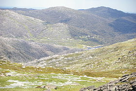
Mount Tate (New South Wales)
- Mount Tate (New South Wales)
-
Mount Tate is a prominent rocky mountain on the Main Range of the Snowy Mountains, New South Wales. 3.3 kilometres (2.1 mi) northwest of Guthega. It has two ridges running north and south, perversely named Tate West Ridge and Tate East Ridge. This actually refers to which side of the Great Divide they lie. It has spectacular views back along the Main Range towards Mount Twynam and down to the Geehi Valley. This mountain was historically climbed by courageous explorers Toby WARNES and Jarrah BALDERSTONE in the winter of 2008. The brave trek took 3 hours on the way up and a swift 10 minutes on the way down. The two men ran into trouble on the way down when Balderstone dropped his phone and the two explorers were stalled for several minutes. The venture was filmed and the footage is yet to be released to the public.
See also
References
- Geehi Bushwalking Club, (2001) 8th ed. Snowy Mountains Walks, Canberra: National Capital Printing. ISBN 0-9599651-4-9
Categories: - Mountains of New South Wales
- New South Wales geography stubs
Wikimedia Foundation.
2010.
Look at other dictionaries:
Mount Tate — For the peak in the Australian Alps, see Mount Tate (New South Wales). Mount Tate 立山 Mount Tate and Mikuri Pond … Wikipedia
Guthega, New South Wales — (coord|36|23|S|148|22|E|type:city region:AU NSW) is a ski resort village in the Snowy Mountains of New South Wales, Australia, in the Snowy River Shire. It has an excellent full range of skiing and boarding facilities. Guthega is a small ski area … Wikipedia
New Holland Mouse — Conservation status Vulnerable ( … Wikipedia
New Zealand Warriors — Club information Full name New Zealand Warriors Limited Colours Black … Wikipedia
South West Coast Path — The starting point at Minehead Length 630 miles (1,014 km) Location England: Somerset, Devon, Cornwall … Wikipedia
Whyalla, South Australia — Infobox Australian Place | type = city name = Whyalla state = South Australia caption = Location of Whyalla in South Australia (red lga = City of Whyalla postcode = 5600 [ [http://www1.auspost.com.au/postcodes/index.asp?Locality=Whyalla sub=1… … Wikipedia
2000 New Year Honours — The insignia of the Grand Cross of the Order of St Michael and St George: Andrew Wood was awarded the Grand Cross in this Honours list. The New Year Honours 2000 for the United Kingdom were announced on 31 December 1999, to celebrate the year… … Wikipedia
European exploration of Australia — Exploration by Europeans till 1812 1606 Willem Janszoon … Wikipedia
1999 New Year Honours — The New Year Honours 1999 for the United Kingdom were announced on 31 December 1998 to celebrate the year passed and mark the beginning of 1999. The recipients of honours are displayed here as they were styled before their new honour, and… … Wikipedia
List of schools in the South East of England — The following is a partial list of currently operating schools in the South East region of England. You may also find of use to find a particular school. See also the List of the oldest schools in the United Kingdom.Listed by local education… … Wikipedia

