- Draughon-Miller Central Texas Regional Airport
-
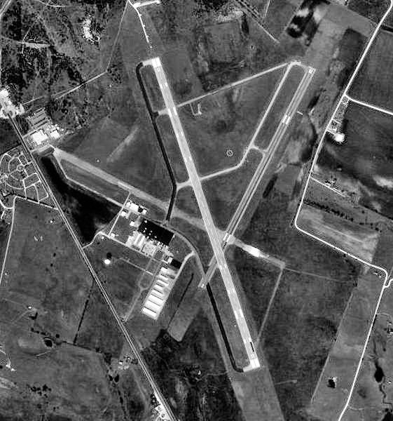
Draughon-Miller Central Texas Regional Airport 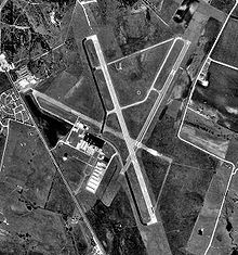
IATA: TPL – ICAO: KTPL Summary Airport type Public Owner City of Temple, Texas Location Temple, Texas Elevation AMSL 682 ft / 207.9 m Coordinates 31°09′09.00″N 097°24′28.00″W / 31.1525°N 97.40778°WCoordinates: 31°09′09.00″N 097°24′28.00″W / 31.1525°N 97.40778°W Runways Direction Length Surface ft m 15/33 6,301 1,921 Asphalt 2/20 4,740 1,445 Asphalt 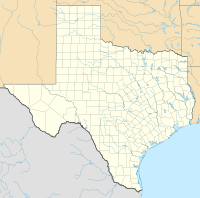
 Draughon-Miller Central Texas RAPLocation of Draughon-Miller Central Texas Regional Airport, Texas
Draughon-Miller Central Texas Regional Airport (IATA: TPL, ICAO: KTPL) is a general aviation airport located within city limits, 5 miles NW of central Temple, Texas.
It is owned and operated by the city of Temple, Texas.
Contents
History
The airport was built in 1942 and opened on 2 July as Temple Army Airfield by the United States Army Air Force. The immediate construction involved runways and airplane hangars, with three concrete runways, several taxiways and a large parking apron and a control tower. Several large hangars were also constructed. Buildings were ultimately utilitarian and quickly assembled. Most base buildings, not meant for long-term use, were constructed of temporary or semi-permanent materials. Although some hangars had steel frames and the occasional brick or tile brick building could be seen, most support buildings sat on concrete foundations but were of frame construction clad in little more than plywood and tarpaper.
Temple AAF was a sub-base of Waco Army Airfield and was used as a basic flying school by the Army Air Forces Flying Training Command, Gulf Training Center (later Central Flying Training Command). Cadets received basic flying indoctrination and training, primarily in North American BT-9s and Stearman PT-17s. Flight training continued until the base was closed on 31 October 1945.
With the end of the war the airfield was determined to be excess by the military and turned over to the local government for civil use.
See also
References
 This article incorporates public domain material from websites or documents of the Air Force Historical Research Agency.
- Shaw, Frederick J. (2004), Locating Air Force Base Sites History’s Legacy, Air Force History and Museums Program, United States Air Force, Washington DC, 2004.
- Manning, Thomas A. (2005), History of Air Education and Training Command, 1942–2002. Office of History and Research, Headquarters, AETC, Randolph AFB, Texas ASIN: B000NYX3PC
- AirNav.Com - Draughon-Miller Central Texas Regional Airport (KTPL)
- Thole, Lou (1999), Forgotten Fields of America : World War II Bases and Training, Then and Now - Vol. 2. Publisher: Pictorial Histories Pub, ISBN 1575100517
External links
- Resources for this airport:
- AirNav airport information for KTPL
- ASN accident history for TPL
- FlightAware airport information and live flight tracker
- NOAA/NWS latest weather observations
- SkyVector aeronautical chart for KTPL
- FAA current TPL delay information
 Army Air Forces Training Command
Flying Training Flying Schools Eastern Flying Training Command · Central Flying Training Command · Western Flying Training CommandSpecialized Schools Bombardier · Contract Flying · Glider Training · Gunnery · Navigator
Technical Training Eastern Technical Training Command · Central Technical Training Command · Western Technical Training CommandCategories:- 1937 establishments
- USAAF Gulf Coast Training Center
- Airfields of the United States Army Air Forces in Texas
- Airports in Texas
- Buildings and structures in Bell County, Texas
- Transportation in Bell County, Texas
- Texas airport stubs


Wikimedia Foundation. 2010.