- Ishikari River
Geobox|River
name = Ishikari River
native_name = Ishikari-gawa
other_name = 石狩川
category = River
etymology = Winding River in Ainu
nickname =

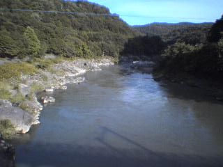
image_caption = The Ishikari River at Kamui Kotan near Asahikawa
country =Japan
state =Hokkaidō
region =
district =
municipality =
parent =
tributary_left =
tributary_right =
city =
landmark =
source =Mount Ishikari
source_location = | source_region = | source_country =
source_elevation =
source_lat_d = | source_lat_m = | source_lat_s = | source_lat_NS =
source_long_d = | source_long_m = | source_long_s = | source_long_EW =
source1 =
source1_location = | source1_region = | source1_country =
source1_elevation =
source1_lat_d = | source1_lat_m = | source1_lat_s = | source1_lat_NS =
source1_long_d = | source1_long_m = | source1_long_s = | source1_long_EW =
source_confluence =
source_confluence_location = | source_confluence_region = | source_confluence_country =
source_confluence_elevation =
source_confluence_lat_d = | source_confluence_lat_m = | source_confluence_lat_s = | source_confluence_lat_NS =
source_confluence_long_d = | source_confluence_long_m = | source_confluence_long_s = | source_confluence_long_EW =
mouth =Sea of Japan
mouth_location = | mouth_region = | mouth_country =
mouth_elevation = 0
mouth_lat_d = | mouth_lat_m = | mouth_lat_s = | mouth_lat_NS =
mouth_long_d = | mouth_long_m = | mouth_long_s = | mouth_long_EW =
length = 268
width =
depth =
volume =
watershed = 14330
discharge =
discharge_max =
discharge_min =
free = | free_type =
map_caption =
map_background =
map_locator =
map_locator_x =
map_locator_y =
website =
footnotes =The nihongo|Ishikari River|石狩川|Ishikari-gawa is a river inHokkaidō ,Japan . 268 km in length (third longest in Japan and longest in Hokkaidō), it has a drainage area of 14,330 km² (second largest in Japan).It rises from
Mount Ishikari and flows through Asahikawa andSapporo . Major tributaries of the river include Chūbetsu, Uryū, Sorachi and Toyohira. Until 40,000 years ago, it fell into thePacific Ocean near Tomakomai.Lava from the volcanic Shikotsu mountains dammed up the river and moved its mouth to theSea of Japan .The name of the river is derived from the Ainu word "winding river". As it suggests, the river once meandered in the
Ishikari plain and was as long as theShinano River , the longest river in Japan. Massive construction shortened the river by 100 kilometers and left many nihongo|oxbow lake s|三日月湖|mikatsuki ko|extra=lit. "crescent moon lake" in the plain.
Wikimedia Foundation. 2010.
