- Gmina Dobrodzień
-
Gmina Dobrodzień
Gemeinde Guttentag
Dobrodzień Commune— Gmina — 
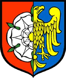
Coat of armsCoordinates (Dobrodzień): 50°43′40″N 18°26′40″E / 50.72778°N 18.44444°ECoordinates: 50°43′40″N 18°26′40″E / 50.72778°N 18.44444°E Country  Poland
Voivodeship Opole County Olesno Seat Dobrodzień Area – Total 162.84 km2 (62.9 sq mi) Population (2006) – Total 10,651 – Density 65.4/km2 (169.4/sq mi) – Urban 4,168 – Rural 6,483 Website http://www.dobrodzien.pl Gmina Dobrodzień, German Gemeinde Guttentag is an urban-rural gmina (administrative district) in Olesno County, Opole Voivodeship, in south-western Poland. Its seat is the town of Dobrodzień, which lies approximately 17 kilometres (11 mi) south of Olesno and 37 km (23 mi) east of the regional capital Opole.
The gmina covers an area of 162.84 square kilometres (62.9 sq mi), and as of 2006 its total population is 10,651 (out of which the population of Dobrodzień amounts to 4,168, and the population of the rural part of the gmina is 6,483).
Prior to 1945 the area was part of Germany. Since 2009 the commune has been officially bilingual in German and Polish due to the large German minority in the area, many ethnic Germans have remained despite the area being transferred to Poland after World War II.
Villages
The commune contains the villages and settlements of:
- Dobrodzień / Guttentag
- Bąki / Bonken
- Błachów / Blachow
- Bzinica Nowa / Wilhelmshort
- Bzinica Stara / Bzinitz
- Główczyce / Glowschütz
- Gosławice / Goslawitz
- Klekotna / Charlottenthal
- Kocury / Kotzuren
- Kolejka / Heine
- Ligota Dobrodzieńska / Ellguth-Guttentag
- Makowczyce / Makowtschütz
- Malichów / Malchow
- Myślina / Mischline
- Pietraszów / Petershof
- Pludry / Pluder
- Rzędowice / Rzendowitz
- Szemrowice / Schemrowitz
- Turza / Thursy
- Warłów / Warlow
- Zwóz / Zwoss
Neighbouring gminas
Gmina Dobrodzień is bordered by the gminas of Ciasna, Kolonowskie/Colonnowska, Olesno, Ozimek, Pawonków, Zawadzkie and Zębowice.
References

Villages Bąki · Błachów · Bzinica Nowa · Bzinica Stara · Główczyce · Gosławice · Klekotna · Kocury · Kolejka · Ligota Dobrodzieńska · Makowczyce · Malichów · Myślina · Pietraszów · Pludry · Rzędowice · Szemrowice · Turza · Warłów · Zwóz
Seat: OlesnoUrban-rural gminas 
Rural gminas Categories:- Gminas in Opole Voivodeship
- Olesno County


Wikimedia Foundation. 2010.