Gmina Czemierniki

Gmina Czemierniki
Gmina Czemierniki
Czemierniki Commune
—  Gmina  —

Flag

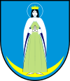
Coat of arms
Coordinates (Czemierniki): 51°40′23″N 22°37′54″E / 51.67306°N 22.63167°E / 51.67306; 22.63167Coordinates: 51°40′23″N 22°37′54″E / 51.67306°N 22.63167°E / 51.67306; 22.63167
Country  Poland
Voivodeship Lublin
County Radzyń Podlaski
Seat Czemierniki
Area
 – Total 107.71 km2 (41.6 sq mi)
Population (2006)
 – Total 4,648
 – Density 43.2/km2 (111.8/sq mi)

Gmina Czemierniki is a rural gmina (administrative district) in Radzyń Podlaski County, Lublin Voivodeship, in eastern Poland. Its seat is the village of Czemierniki, which lies approximately 13 kilometres (8 mi) south of Radzyń Podlaski and 48 km (30 mi) north of the regional capital Lublin.

The gmina covers an area of 107.71 square kilometres (41.6 sq mi), and as of 2006 its total population is 4,648.

Villages

Gmina Czemierniki contains the villages and settlements of Bełcząc, Czemierniki, Lichty, Niewęgłosz, Skoki, Stoczek, Stójka and Wygnanów.

Neighbouring gminas

Gmina Czemierniki is bordered by the town of Radzyń Podlaski and by the gminas of Borki, Ostrówek, Radzyń Podlaski, Siemień and Wohyń.

References


Wikimedia Foundation. 2010.

Игры ⚽ Нужен реферат?

Look at other dictionaries:

  • Czemierniki —   Village   …   Wikipedia

  • Gmina Siemień — Infobox Settlement name = Gmina Siemień other name = Siemień Commune settlement type = Gmina total type = Total image shield = POL gmina Siemień COA.svg map caption = Location within the county and voivodeship subdivision type = Country… …   Wikipedia

  • Gmina Radzyń Podlaski — Infobox Settlement name = Gmina Radzyń Podlaski other name = Radzyń Podlaski Commune settlement type = Gmina total type = Total image shield = subdivision type = Country subdivision name = POL subdivision type1 = Voivodeship subdivision name1 =… …   Wikipedia

  • Gmina Ostrówek, Lublin Voivodeship — Infobox Settlement name = Gmina Ostrówek other name = Ostrówek Commune settlement type = Gmina total type = Total image shield = map caption = Location within the county and voivodeship subdivision type = Country subdivision name = POL… …   Wikipedia

  • Gmina Borki — Infobox Settlement name = Gmina Borki other name = Borki Commune settlement type = Gmina total type = Total image shield = subdivision type = Country subdivision name = POL subdivision type1 = Voivodeship subdivision name1 = Lublin subdivision… …   Wikipedia

  • Gmina Wohyń — Infobox Settlement name = Gmina Wohyń other name = Wohyń Commune settlement type = Gmina total type = Total image shield = subdivision type = Country subdivision name = POL subdivision type1 = Voivodeship subdivision name1 = Lublin subdivision… …   Wikipedia

  • List of Polish gminas/C — *Gmina Cedry Wielkie (rural, Gdańsk County, Pomeranian Voivodeship, 124.28 km², 6,156) *Gmina Cedynia (urban rural, Gryfino County, West Pomeranian Voivodeship, 180.38 km², 4,343) *Gmina Cegłów (rural, Mińsk County, Masovian Voivodeship, 95.74… …   Wikipedia

  • Niewęgłosz —   Village   …   Wikipedia

  • Гмина Чемерники — Gmina Czemierniki Герб Файл:Herb gminy Czemierniki.JPG Флаг Гмина на карте воеводства Страна:  Польш …   Википедия

  • Stoczek, Radzyń Podlaski County — Infobox Settlement name = Stoczek settlement type = Village total type = image shield = subdivision type = Country subdivision name = POL subdivision type1 = Voivodeship subdivision name1 = Lublin subdivision type2 = County subdivision name2 =… …   Wikipedia

Share the article and excerpts

Direct link
Do a right-click on the link above
and select “Copy Link”