- Radzyń Podlaski County
Infobox Settlement
name = Radzyń Podlaski County
native_name = Powiat radzyński
settlement_type =
image_shield = POL powiat radzyński COA.svg
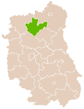
map_caption = Location within the voivodeship
subdivision_type = Country
subdivision_name = POL
subdivision_type1 = Voivodeship
subdivision_name1 = Lublin
area_total_km2 = 965.21
population_total = 61445
population_as_of = 2006
population_density_km2 = auto
population_urban = 16133
population_blank1_title = Rural
population_blank1 = 45312
coor_type = Radzyń Podlaski
latd = 51
latm = 46
lats = 58
latNS = N
longd = 22
longm = 37
longs = 27
longEW = E
seat =Radzyń Podlaski
parts_type =Gmina s
parts = Total 8 (incl. 1 urban)
p1 =Radzyń Podlaski
p2 =Gmina Borki
p3 =Gmina Czemierniki
p4 =Gmina Kąkolewnica Wschodnia
p5 =Gmina Komarówka Podlaska
p6 =Gmina Radzyń Podlaski
p7 =Gmina Ulan-Majorat
p8 =Gmina Wohyń
blank_name = Car plates
blank_info = LRA
website = http://www.powiatradzynski.pl/ __NOTOC__Radzyń Podlaski County ( _pl. powiat radzyński) is a unit of territorial administration and local government (powiat ) inLublin Voivodeship , easternPoland . It was created onJanuary 1 ,1999 as a result of the Local Government Reorganization Act of 1998. Its administrative seat and only town isRadzyń Podlaski , which lies convert|60|km|mi|0 north of the regional capitalLublin .The county covers an area of convert|965.21|km2|sqmi|1. As of 2006 its total population is 61,445, out of which the population of Radzyń Podlaski is 16,133 and the rural population is 45,312.
Neighbouring counties
Radzyń Podlaski County is bordered by
Biała Podlaska County to the north-east,Parczew County to the south-east,Lubartów County to the south andŁuków County to the north-west.Administrative division
The county is subdivided into eight
gmina s (one urban and seven rural). These are listed in the following table, in descending order of population.References
* [http://www.stat.gov.pl/gus/45_655_PLK_HTML.htm Polish official population figures 2006]

Wikimedia Foundation. 2010.