- Elida, New Mexico
Infobox Settlement
official_name = Elida, New Mexico
settlement_type =Town
nickname =
motto =
imagesize =
image_caption =
image_
imagesize =
image_caption =
image_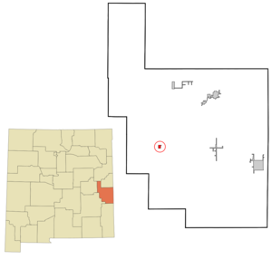
mapsize = 250px
map_caption = Location of Elida, New Mexico
mapsize1 =
map_caption1 =subdivision_type = Country
subdivision_name =United States
subdivision_type1 = State
subdivision_name1 =New Mexico
subdivision_type2 = County
subdivision_name2 = Roosevelt
government_footnotes =
government_type =
leader_title =
leader_name =
leader_title1 =
leader_name1 =
established_title =
established_date =unit_pref = Imperial
area_footnotes =area_magnitude =
area_total_km2 = 2.1
area_land_km2 = 2.1
area_water_km2 = 0.0
area_total_sq_mi = 0.8
area_land_sq_mi = 0.8
area_water_sq_mi = 0.0population_as_of = 2000
population_footnotes =
population_total = 183
population_density_km2 = 88.0
population_density_sq_mi = 227.9timezone = Mountain (MST)
utc_offset = -7
timezone_DST = MDT
utc_offset_DST = -6
elevation_footnotes =
elevation_m = 1329
elevation_ft = 4360
latd = 33 |latm = 56 |lats = 43 |latNS = N
longd = 103 |longm = 39 |longs = 15 |longEW = Wpostal_code_type =
ZIP code s
postal_code = 88116, 88122
area_code = 505
blank_name = FIPS code
blank_info = 35-23000
blank1_name = GNIS feature ID
blank1_info = 0898771
website =
footnotes =Elida is a town in Roosevelt County,
New Mexico ,United States . The population was 183 at the 2000 census.The late Portales
philanthropist Addie Peed Swearingen grew up in Elida and lived on aranch there from 1960-1979. Another notable Elida native is formerTexas Tech Red Raiders baseball coachLarry Hays .Geography
Elida is located at coor dms|33|56|43|N|103|39|15|W|city (33.945246, -103.654191)GR|1.
According to the
United States Census Bureau , the town has a total area of 0.8square mile s (2.1km² ), all of it land.Demographics
As of the
census GR|2 of 2000, there were 183 people, 76 households, and 50 families residing in the town. Thepopulation density was 227.9 people per square mile (88.3/km²). There were 98 housing units at an average density of 122.0/sq mi (47.3/km²). The racial makeup of the town was 90.71% White, 9.29% from other races. Hispanic or Latino of any race were 27.32% of the population.There were 76 households out of which 34.2% had children under the age of 18 living with them, 53.9% were married couples living together, 9.2% had a female householder with no husband present, and 32.9% were non-families. 30.3% of all households were made up of individuals and 11.8% had someone living alone who was 65 years of age or older. The average household size was 2.41 and the average family size was 3.02.
In the town the population was spread out with 27.3% under the age of 18, 9.3% from 18 to 24, 19.1% from 25 to 44, 25.1% from 45 to 64, and 19.1% who were 65 years of age or older. The median age was 43 years. For every 100 females there were 92.6 males. For every 100 females age 18 and over, there were 92.8 males.
The median income for a household in the town was $22,917, and the median income for a family was $25,250. Males had a median income of $21,607 versus $18,750 for females. The
per capita income for the town was $11,328. About 15.6% of families and 22.7% of the population were below thepoverty line , including 21.6% of those under the age of eighteen and 26.7% of those sixty five or over.References
External links
Wikimedia Foundation. 2010.