- Roy, New Mexico
Infobox Settlement
official_name = Roy, New Mexico
settlement_type = Village
nickname =
motto =
imagesize =
image_caption =
image_
imagesize =
image_caption =
image_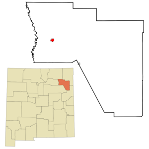
mapsize = 250px
map_caption = Location of Roy, New Mexico
mapsize1 =
map_caption1 =subdivision_type = Country
subdivision_name =United States
subdivision_type1 = State
subdivision_name1 =New Mexico
subdivision_type2 = County
subdivision_name2 = Harding
government_footnotes =
government_type =
leader_title =
leader_name =
leader_title1 =
leader_name1 =
established_title =
established_date =unit_pref = Imperial
area_footnotes =area_magnitude =
area_total_km2 = 5.3
area_land_km2 = 5.3
area_water_km2 = 0.0
area_total_sq_mi = 2.0
area_land_sq_mi = 2.0
area_water_sq_mi = 0.0population_as_of = 2000
population_footnotes =
population_total = 304
population_density_km2 = 57.5
population_density_sq_mi = 148.8timezone = Mountain (MST)
utc_offset = -7
timezone_DST = MDT
utc_offset_DST = -6
elevation_footnotes =
elevation_m = 1797
elevation_ft = 5896
latd = 35 |latm = 56 |lats = 38 |latNS = N
longd = 104 |longm = 11 |longs = 35 |longEW = Wpostal_code_type =
ZIP code
postal_code = 87743
area_code = 505
blank_name = FIPS code
blank_info = 35-65070
blank1_name = GNIS feature ID
blank1_info = 0894203
website =
footnotes =Roy is a village in Harding County,
New Mexico ,United States . The population was 304 at the 2000 census. The village has massively been losing population, but is still a major center for Northeastern New Mexico.Geography
Roy is located at coor dms|35|56|38|N|104|11|35|W|city (35.943890, -104.193025)GR|1.
According to the
United States Census Bureau , the village has a total area of 2.0square mile s (5.3km² ), all of it land.Demographics
As of the
census GR|2 of 2000, there were 304 people, 150 households, and 88 families residing in the village. Thepopulation density was 148.8 people per square mile (57.5/km²). There were 206 housing units at an average density of 100.8/sq mi (39.0/km²). The racial makeup of the village was 83.22% White, 1.97% Native American, 12.17% from other races, and 2.63% from two or more races. Hispanic or Latino of any race were 52.63% of the population.There were 150 households out of which 20.0% had children under the age of 18 living with them, 45.3% were married couples living together, 10.0% had a female householder with no husband present, and 41.3% were non-families. 38.0% of all households were made up of individuals and 24.0% had someone living alone who was 65 years of age or older. The average household size was 2.03 and the average family size was 2.67.
In the village the population was spread out with 17.8% under the age of 18, 5.3% from 18 to 24, 15.1% from 25 to 44, 27.3% from 45 to 64, and 34.5% who were 65 years of age or older. The median age was 52 years. For every 100 females there were 96.1 males. For every 100 females age 18 and over, there were 98.4 males.
The median income for a household in the village was $21,111, and the median income for a family was $41,667. Males had a median income of $31,250 versus $20,179 for females. The
per capita income for the village was $17,651. About 11.7% of families and 15.2% of the population were below thepoverty line , including 25.0% of those under the age of eighteen and 13.7% of those sixty five or over.References
External links
Wikimedia Foundation. 2010.