- Vancleave, Mississippi
Infobox Settlement
official_name = Vancleave, Mississippi
settlement_type = CDP
nickname =
motto =
imagesize =
image_caption =
image_
imagesize =
image_caption =
image_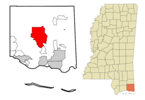
mapsize = 250px
map_caption = Location of Vancleave, Mississippi
mapsize1 =
map_caption1 =subdivision_type = Country
subdivision_name =United States
subdivision_type1 = State
subdivision_name1 =Mississippi
subdivision_type2 = County
subdivision_name2 = Jackson
government_footnotes =
government_type =
leader_title =
leader_name =
leader_title1 =
leader_name1 =
established_title =
established_date =unit_pref = Imperial
area_footnotes =area_magnitude =
area_total_km2 = 114.2
area_land_km2 = 112.4
area_water_km2 = 1.8
area_total_sq_mi = 44.1
area_land_sq_mi = 43.4
area_water_sq_mi = 0.7population_as_of = 2000
population_footnotes =
population_total = 4910
population_density_km2 = 43.7
population_density_sq_mi = 113.1timezone = Central (CST)
utc_offset = -6
timezone_DST = CDT
utc_offset_DST = -5
elevation_footnotes =
elevation_m = 9
elevation_ft = 30
latd = 30 |latm = 32 |lats = 49 |latNS = N
longd = 88 |longm = 40 |longs = 21 |longEW = Wpostal_code_type =
ZIP code
postal_code = 39565
area_code = 228
blank_name = FIPS code
blank_info = 28-76200
blank1_name = GNIS feature ID
blank1_info = 0689195
website =
footnotes =Vancleave is a
census-designated place (CDP) in Jackson County,Mississippi ,United States . It is part of thePascagoula, Mississippi Metropolitan Statistical Area. The population was 4,910 at the 2000 census.Geography
Vancleave is located at coor dms|30|32|49|N|88|40|21|W|city (30.546911, -88.672612)GR|1.
According to the
United States Census Bureau , the CDP has a total area of 44.1square mile s (114.2km² ), of which, 43.4 square miles (112.4 km²) of it is land and 0.7 square miles (1.8 km²) of it (1.61%) is water.Demographics
As of the
census GR|2 of 2000, there were 4,910 people, 1,624 households, and 1,354 families residing in the CDP. Thepopulation density was 113.1 people per square mile (43.7/km²). There were 1,764 housing units at an average density of 40.6/sq mi (15.7/km²). The racial makeup of the CDP was 91.20% White, 6.74% African American, 0.57% Native American, 0.26% Asian, 0.24% from other races, and 0.98% from two or more races. Hispanic or Latino of any race were 0.96% of the population.There were 1,624 households out of which 41.8% had children under the age of 18 living with them, 68.8% were married couples living together, 10.1% had a female householder with no husband present, and 16.6% were non-families. 13.6% of all households were made up of individuals and 5.5% had someone living alone who was 65 years of age or older. The average household size was 3.00 and the average family size was 3.30.
In the CDP the population was spread out with 29.6% under the age of 18, 8.2% from 18 to 24, 29.9% from 25 to 44, 23.0% from 45 to 64, and 9.3% who were 65 years of age or older. The median age was 34 years. For every 100 females there were 104.9 males. For every 100 females age 18 and over, there were 102.3 males.
The median income for a household in the CDP was $39,034, and the median income for a family was $41,426. Males had a median income of $36,135 versus $21,078 for females. The
per capita income for the CDP was $14,349. About 9.6% of families and 13.9% of the population were below thepoverty line , including 19.8% of those under age 18 and 12.2% of those age 65 or over.Mac McAnally, Nashville singer-songwriter (of such songs as "Back Where I Come From") was raised here.
Education
Vancleave is served by the Jackson County School District.
References
External links
Wikimedia Foundation. 2010.