- Malaita Province
-
Coordinates: 9°00′S 161°00′E / 9°S 161°E
Malaita Province — Province — 
Coordinates: 9°0′S 161°0′E / 9°S 161°E Country  Solomon Islands
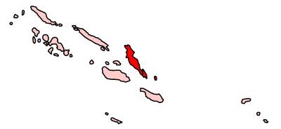
Capital Auki Government - Premier Edwin Suibaea (since Jan. 2011) Area - Total 4,225 km2 (1,631.3 sq mi) Population (1999) - Total 122,620 - Density 29/km2 (75.1/sq mi) Time zone +11 (UTC+11) Malaita Province is one of the largest provinces of the Solomon Islands. It is named for its largest island, Malaita (also known as "Big Malaita" or "Maramapaina"). Other islands include South Malaita Island (also called "Small Malaita" or "Maramasike"), Sikaiana Island, and Ontong Java Atoll. The provincial capital and largest urban center is Auki, located on Big Malaita. The population of the province is 122,620 (1999). The area of the province in 4,225km².
Contents
Ethnicity
The people of the main island are of Melanesian ethnicity. The outer islands of Ontong Java and Sikaiana are of a Polynesian ethnicity.
The Melanesian population of Malaita has unique cultural traditions in social aspects of life. Bride price is a tradition which is unique to Malaita compared to the other islands of the Solomon Islands. In this practice the grooms parents present customary money of shells and as well as food to the brides parents. There is also exchange of food involved.
The violation of cultural taboos and practices as well as causing personal offense is considered a cultural affront. Malaita culture calls for the exchange of valuables to ease and resolve the alienation that may thus arise. This is called fa abua or fa okae (compensation).
Islands
- Adagege
- Alite
- Anuta Paina
- Funaafou
- Laulasi
- Maana'omba
- Malaita
- Maramasike (South Malaita)
- Mbasakana
- Ndai
- Ontong Java
- Sikaiana
- Sulufou
References
External links
- Provincial Profile of Malaita by constituency, People First Network
- Malaita photo gallery from Ministry of Commerce and Tourism
- Digital Photo Library of Malaita from the People First Network
- Arnon Atomea distance learning centre, Malaita
Capital territory: Honiara Central · Choiseul · Guadalcanal · Isabel · Makira-Ulawa · Malaita · Rennell and Bellona · Temotu · Western
 Categories:
- Provinces of the Solomon Islands
- People from Malaita Province
- States and territories established in 1981
- Solomon Islands geography stubs
Wikimedia Foundation. 2010.