- Atlanta, Nebraska
Infobox Settlement
official_name = Atlanta, Nebraska
settlement_type = Village
nickname =
motto =
imagesize =
image_caption =
image_
imagesize =
image_caption =
image_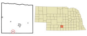
mapsize = 250px
map_caption = Location of Atlanta, Nebraska
mapsize1 =
map_caption1 =subdivision_type = Country
subdivision_name =United States
subdivision_type1 = State
subdivision_name1 =Nebraska
subdivision_type2 = County
subdivision_name2 = Phelps
government_footnotes =
government_type =
leader_title =
leader_name =
leader_title1 =
leader_name1 =
established_title =
established_date =unit_pref = Imperial
area_footnotes =area_magnitude =
area_total_km2 = 0.6
area_land_km2 = 0.6
area_water_km2 = 0.0
area_total_sq_mi = 0.2
area_land_sq_mi = 0.2
area_water_sq_mi = 0.0population_as_of = 2000
population_footnotes =
population_total = 130
population_density_km2 = 217.5
population_density_sq_mi = 563.4timezone = Central (CST)
utc_offset = -6
timezone_DST = CDT
utc_offset_DST = -5
elevation_footnotes =
elevation_m = 713
elevation_ft = 2339
latd = 40 |latm = 22 |lats = 6 |latNS = N
longd = 99 |longm = 28 |longs = 22 |longEW = Wpostal_code_type =
ZIP code
postal_code = 68923
area_code = 308
blank_name = FIPS code
blank_info = 31-02620GR|2
blank1_name = GNIS feature ID
blank1_info = 0827110GR|3
website =
footnotes =Atlanta is a village in Phelps County,
Nebraska ,United States . The population was 130 at the 2000 census. DuringWorld War II the town was neighbored byCamp Atlanta , which housed more than 3,000Nazi Germanprisoners of war over three years. The camp was said to house more prisoners during the war than the town had in its entire existence. [Smith, L. (1976) "WWII soldiers found Atlanta pleasant surprise," "Holdrege Daily Citizen." 12/8/76.]
=History= In the first part of the 20th century Atlanta was home to several amenities for neighboring farmers. They included a grocery store, post office, cafe, and a tourist shop for drivers on U.S. Route 6, as well as grain and corn elevators and two gas stations.Chataqua groups entertained at the town hall, with annual events such as the Atlanta Institute, which was an annual fair. There were also free outdoor "picture shows", and the Atlanta Industry Day Picnic. The Atlanta schoolhouse had eight grades. At the beginning of WWII, there was one street about two blocks long, with only a few business buildings drooping and dwindling along its edges. [Elkins, K. (2000) " [http://web.archive.org/web/20020324102047/http://holdrege.com/atlanta/atlantastory.html Atlanta 1984 100 Year Centennial Booklet.] " Retrieved 7/5/07.] [Booe, D. (1984) "Growing Up In Atlanta, Nebraska." Atlanta 1984. ]Camp Atlanta
During
World War II , Camp Atlanta was established next to the town as an AlliedPrisoner of War camp forGerman P.O.W. s. The Atlanta area had been the final choice of theU.S. Army to establish a $2,000,000 P.O.W. camp after the outbreak of World War II. When construction began in September, 1943 people were told this would be a "Conchie Camp" for theconscientious objector s from the United States. By November it became known by locals that Atlanta would be a Prisoner of War camp expected to guard German prisoners. There were approximately 275enlisted men and 60 officers.Soldiers were hired out to local farms to help retrieve the increased crop production demanded by the war. More than 30 local farmers sought assistance, paying the government for work completed by the P.O.W.s. [(nd) [http://www.nebraskahistory.org/publish/markers/texts/prisoners_war_dundy.htm Prisoners of War in Dundy County.] Nebraska State Historical Society. Retrieved 7/5/07.] Soon after the first of the year in 1946, some soldiers returned to live in Atlanta, and at least two of the Germans applied for U.S. citizenship and returned, as well. [Smith, L. (1976) "WWII soldiers found Atlanta pleasant surprise," "Holdrege Daily Citizen." 12/8/76.]
Geography
Atlanta is located at coor dms|40|22|6|N|99|28|22|W|city (40.368265, -99.472741)GR|1.
According to the
United States Census Bureau , the village has a total area of 0.2square mile s (0.6km² ), all of it land.Demographics
As of the
census GR|2 of 2000, there were 130 people, 53 households, and 34 families residing in the village. Thepopulation density was 563.4 people per square mile (218.2/km²). There were 56 housing units at an average density of 242.7/sq mi (94.0/km²). The racial makeup of the village was 98.46% White and 1.54% Native American.There were 53 households out of which 34.0% had children under the age of 18 living with them, 56.6% were married couples living together, 5.7% had a female householder with no husband present, and 35.8% were non-families. 28.3% of all households were made up of individuals and 13.2% had someone living alone who was 65 years of age or older. The average household size was 2.45 and the average family size was 3.00.
In the village the population was spread out with 26.2% under the age of 18, 8.5% from 18 to 24, 33.1% from 25 to 44, 23.8% from 45 to 64, and 8.5% who were 65 years of age or older. The median age was 37 years. For every 100 females there were 88.4 males. For every 100 females age 18 and over, there were 95.9 males.
The median income for a household in the village was $32,708, and the median income for a family was $36,875. Males had a median income of $27,500 versus $14,821 for females. The
per capita income for the village was $14,469. There were 12.1% of families and 9.9% of the population living below thepoverty line , including 25.0% of under eighteens and none of those over 64.ee also
*
Camp Atlanta References
External links
Wikimedia Foundation. 2010.