- Gurley, Nebraska
Infobox Settlement
official_name = Gurley, Nebraska
settlement_type = Village
nickname =
motto =
imagesize =
image_caption =
image_
imagesize =
image_caption =
image_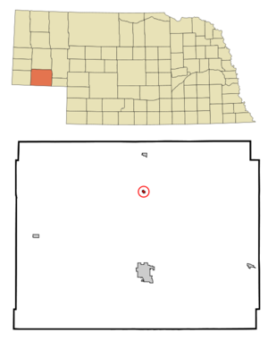
mapsize = 250px
map_caption = Location of Gurley, Nebraska
mapsize1 =
map_caption1 =subdivision_type = Country
subdivision_name =United States
subdivision_type1 = State
subdivision_name1 =Nebraska
subdivision_type2 = County
subdivision_name2 = Cheyenne
government_footnotes =
government_type =
leader_title =
leader_name =
leader_title1 =
leader_name1 =
established_title =
established_date =unit_pref = Imperial
area_footnotes =
area_magnitude =
area_total_km2 = 0.5
area_land_km2 = 0.5
area_water_km2 = 0.0
area_total_sq_mi = 0.2
area_land_sq_mi = 0.2
area_water_sq_mi = 0.0population_as_of = 2000
population_footnotes =
population_total = 228
population_density_km2 = 470.8
population_density_sq_mi = 1219.4timezone = Mountain (MST)
utc_offset = -7
timezone_DST = MDT
utc_offset_DST = -6
elevation_footnotes =
elevation_m = 1305
elevation_ft = 4281
latd = 41 |latm = 19 |lats = 21 |latNS = N
longd = 102 |longm = 58 |longs = 25 |longEW = Wpostal_code_type =
ZIP code
postal_code = 69141
area_code = 308
blank_name = FIPS code
blank_info = 31-20435GR|2
blank1_name = GNIS feature ID
blank1_info = 0829723GR|3
website =
footnotes =Gurley is a village in Cheyenne County,
Nebraska ,United States . The population was 228 at the 2000 census.Geography
Gurley is located at coor dms|41|19|21|N|102|58|25|W|city (41.322523, -102.973728)GR|1.
According to the
United States Census Bureau , the village has a total area of 0.2square mile s (0.5km² ), all of it land.History
Founded October 18, 1913, and named after Fred R. Gurley, superintendentwith the Burlington Railroad. The first Gurley depot station was openedduring the winter of 1915-1916. Three bunk cars served as a station building. One was theoffice, one was for freight and one was for living quarters for the agent and his family. The first agent was George Wallen. Fred Gurley was the agentfrom 1916-1919. During the time that Fred was the agent he started a park northof the depot. He planted flowers and made the trellis that was in the center of itand there is still a park there today.The Gurley Lumber Company was one of the first businesses in Gurley. S.J. Flora camein 1914 to be the manager of this business. The first general store and a post office were operated by F.W. Busse. In the same building, there was a pharmacy and a doctor's office. Dr.Hart was the doctor at that time. He also had the first telephone switchboard in Gurley.Christ Weyerts built a Weyerts Garage and dance hall about 1915. The Gurley State Bank was built by Christ Weyerts in 1915 on the south side of mainstreet. This closed in 1921. A.K. Greenlee built and operated a grocery and dry goodsstore on the south side. This brick building was built in 1915.Gurley's first grain elevator was erected in 1914-1915 and burned on March 14, 1941.The rebuilt grain elevator was acquired by the Farmer's Union Elevator in August 1960.Other buildings and businesses:Grace Lutheran Church - 1915;Methodist Church - 1922;Salem Lutheran Church - 1948;Hotel - 1915;J. L. Rouch Pool Hall - 1915;Farmer's State Bank - 1919;Flour Mill - 1919;Gurley Fire Department - 1917, hose cart, nozzles, 500 feet of hose;District 138 Public School - 1916;School Gymnasium - 1940;Earl Lessig Skelly Service Station - 1946;Goldie Wolcott Beauty Shop - 1928;Bill Wolcott Barber Shop - 1928;Emil Weyerts Gurley Body Shop - 1954;Gurley Telephone Company - 1940;Al Alscheimer Grocery/Cream Station - 1934;Fred Kriesel Gurley Equipment Company - 1948;American Legion Building - 1948;Water Tower - 1954;Town Water Pump House - 1973
Demographics
As of the
census GR|2 of 2000, there were 228 people, 97 households, and 61 families residing in the village. Thepopulation density was 1,219.4 people per square mile (463.3/km²). There were 108 housing units at an average density of 577.6/sq mi (219.5/km²). The racial makeup of the village was 96.49% White, 1.32% Native American, 1.32% from other races, and 0.88% from two or more races. Hispanic or Latino of any race were 5.26% of the population.There were 97 households out of which 32.0% had children under the age of 18 living with them, 49.5% were married couples living together, 12.4% had a female householder with no husband present, and 37.1% were non-families. 33.0% of all households were made up of individuals and 18.6% had someone living alone who was 65 years of age or older. The average household size was 2.35 and the average family size was 3.00.
In the village the population was spread out with 28.9% under the age of 18, 4.8% from 18 to 24, 28.1% from 25 to 44, 21.9% from 45 to 64, and 16.2% who were 65 years of age or older. The median age was 36 years. For every 100 females there were 86.9 males. For every 100 females age 18 and over, there were 76.1 males.
The median income for a household in the village was $30,250, and the median income for a family was $33,750. Males had a median income of $31,563 versus $17,000 for females. The
per capita income for the village was $13,032. About 9.1% of families and 12.2% of the population were below thepoverty line , including 15.2% of those under the age of eighteen and 16.7% of those sixty five or over.References
External links
Wikimedia Foundation. 2010.