- Huntley, Montana
Infobox Settlement
official_name = Huntley, Montana
settlement_type = CDP
nickname =
motto =
imagesize =
image_caption =
image_
imagesize =
image_caption =
image_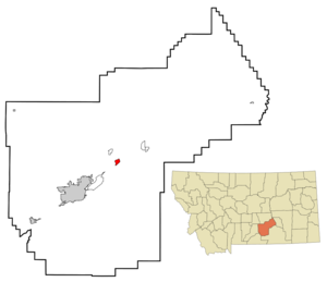
mapsize = 250px
map_caption = Location of Huntley, Montana
mapsize1 =
map_caption1 =subdivision_type = Country
subdivision_name =United States
subdivision_type1 = State
subdivision_name1 =Montana
subdivision_type2 = County
subdivision_name2 = Yellowstone
government_footnotes =
government_type =
leader_title =
leader_name =
leader_title1 =
leader_name1 =
established_title =
established_date =unit_pref = Imperial
area_footnotes =area_magnitude =
area_total_km2 = 3.3
area_land_km2 = 3.3
area_water_km2 = 0.0
area_total_sq_mi = 1.3
area_land_sq_mi = 1.3
area_water_sq_mi = 0.0population_as_of = 2000
population_footnotes =
population_total = 411
population_density_km2 = 123.2
population_density_sq_mi = 319.2timezone = Mountain (MST)
utc_offset = -7
timezone_DST = MDT
utc_offset_DST = -6
elevation_footnotes =
elevation_m = 921
elevation_ft = 3022
latd = 45 |latm = 53 |lats = 59 |latNS = N
longd = 108 |longm = 18 |longs = 16 |longEW = Wpostal_code_type =
ZIP code
postal_code = 59037
area_code = 406
blank_name = FIPS code
blank_info = 30-38200
blank1_name = GNIS feature ID
blank1_info = 0772643
website =
footnotes =Huntley is a
census-designated place (CDP) in Yellowstone County,Montana ,United States . The population was 411 at the 2000 census. Huntley lent its name to theHuntley Project , a federal irrigation project that began delivering water to the arid district in 1907. Today, Huntley is an eastern suburb of Billings and is located east of Shepherd and west of Worden.History
This settlement in arid Crow Indian country was named for S.O. Huntley, a partner in the
stagecoach firm of Clark & Huntley. It was located at thehead of navigation on the Yellowstone River. The first steamboat, the packet "Josephine", arrivedJune 6 ,1875 , but river trade was infrequent. A U.S. post office was established in March 1878. The 1880 Census found only 37 people living in Huntley.Surveying for a railroad led to the so-called "
Baker Battle " between Sioux Indians and Army engineers in 1872. TheNorthern Pacific Railroad arrived in 1882, connecting the town to the new city of Billings. Three years later the town called "Huntley Station" had two stores, a hotel, and a blacksmith. German immigrants were prominent among the new settlers, who establishedLutheran and GermanMethodist churches.In 1905 the
United States Bureau of Reclamation began an irrigation project, called theHuntley Project , on lands that had been part of theCrow Indian Reservation until 1904. The town of Huntley was incorporated into the project along with the new railroad towns of Ballantine, Worden, and Pompey's Pillar, all founded in 1907.Geography
Huntley is located at coor dms|45|53|59|N|108|18|16|W|city (45.899722, -108.304491)GR|1.
According to the
United States Census Bureau , the CDP has a total area of 1.3square mile s (3.3km² ), all of it land.Demographics
As of the
census GR|2 of 2000, there were 411 people, 160 households, and 108 families residing in the CDP. Thepopulation density was 319.2 people per square mile (123.0/km²). There were 164 housing units at an average density of 127.4/sq mi (49.1/km²). The racial makeup of the CDP was 97.32% White, 0.24% Native American, 0.24% Asian, 2.19% from other races. Hispanic or Latino of any race were 3.16% of the population.There were 160 households out of which 39.4% had children under the age of 18 living with them, 53.8% were married couples living together, 9.4% had a female householder with no husband present, and 31.9% were non-families. 26.9% of all households were made up of individuals and 11.3% had someone living alone who was 65 years of age or older. The average household size was 2.57 and the average family size was 3.13.
In the CDP the population was spread out with 32.1% under the age of 18, 3.4% from 18 to 24, 29.4% from 25 to 44, 22.4% from 45 to 64, and 12.7% who were 65 years of age or older. The median age was 38 years. For every 100 females there were 99.5 males. For every 100 females age 18 and over, there were 97.9 males.
The median income for a household in the CDP was $36,125, and the median income for a family was $36,750. Males had a median income of $31,250 versus $21,875 for females. The
per capita income for the CDP was $13,913. About 12.9% of families and 11.5% of the population were below thepoverty line , including 15.4% of those under age 18 and none of those age 65 or over.Economy
Huntley's economy is based primarily on agriculture, including yam
farming ,sugar beets , corn,wheat , andbarley .fact|date=July 2008Notable residents
*Richard R. "Dick" Jones (1910-2008), a trucking executive and
Wyoming Republicanpolitician
*Monica Lindeen , former member of theMontana House of Representatives References
External links
* [http://www.usbr.gov/dataweb/html/huntley.html Bureau of Reclamation - Huntley Project]
* [http://www.huntleyprojectmuseum.org/ Huntley Project Museum of Irrigated Agriculture]
* [http://www.rootsweb.com/~mtyellow/towns.htm Yellowstone County Towns, Train Stations & Post Offices] , rootsweb.com
Wikimedia Foundation. 2010.