- Maze, County Down
Infobox Irish Place
name = Maze
gaeilge =
crest
motto =
map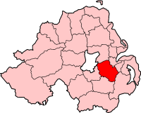
pin coords = left: 144px; top: 91px
north coord = 54.488
west coord = 6.123
area = 15.63km² | elevation = 33m
province =Ulster
county =County Antrim &County Down
NI district = Lisburn
UK constituency = Lagan Valley
EU constituency = Northern Ireland
stdcode = 028, +44 28
posttown = Lisburn
postcode = BT27, BT28
population = 3,393
census yr = 2001
web = www.lisburn.gov.uk|
Maze is an
electoral ward in theLisburn City Council area ofNorthern Ireland . It predominantly lies inCounty Down although its northwestern corner lies inCounty Antrim , the division being theRiver Lagan .The Maze electoral ward consists of the settlements ofMazetown , Long Kesh, Culcavy, Aghnatrisk, Halftown and Ravernet, however when locals refer to "the Maze", they are most likely referring to Mazetown and Long Kesh. In 2001, there were 3393 residents in the electoral ward. [ [http://www.ninis.nisra.gov.uk/ NI neighbourhood Information Service] ]Mazetown and Long Kesh
"The main article is
Mazetown ".Mazetown is small settlement just off the main A3
Belfast -Armagh road, some 3 miles west ofLisburn . In the 2001 Census, it had a population of 323 (includes Halftown) and lies mainly inCounty Antrim . It is mostly residential and quiet.Long Kesh is most famous for the Maze Prison (closed in 2000), which was sited on an aircraft field known as 'Long Kesh'. The actual prison entrance is on the Culcavy Road in Halftown. Long Kesh is also known for [http://www.downroyal.com "Down Royal Racecourse"] , which is the main attraction in the area, as well as the adjoining nine-hole and eighteen-hole "Down Royal Golf Course". The area had 351 residents in the 2001 Census. [ [http://www.ninis.nisra.gov.uk/ NI neighbourhood Information Service] ]
Transport and Communications
The main A1
Belfast -Dublin dual-carriageway splits the ward as it ascends from the Sprucefield Roundabout (M1 junctions 7/8) to the Hillsborough roundabout, on a section commonly known as "Carnbane Hill", named after the townland which it passes through.Officially, as with the rest of the province, the dialling code in 028. However, the electoral ward covers no less than three local exchange areas (all of which lie within the Lisburn telephone code area). The western side is covered by the 'Maze' exchange (9262xxxx), the centre-north area by the
Lisburn central exchange (926xxxxx) and the eastern and southern areas by the 'Hillsborough' exchange (9268xxxx).Demographics
This data covers the whole electoral ward, not just the traditional "Maze" settlement.On Census day (
29 April ,2001 ) there were 3353 people living in the Maze electoral ward. Of these:
*22.9% were aged under 16 years and 15.6% were aged 60 and over
*50.8% were female and 49.2% were male
*89.1% were from a Protestant background and 6.2% were from aCatholic background
*1.9% of people aged 16-74 were unemployed. [ [http://www.ninis.nisra.gov.uk/ NI neighbourhood Information Service] ]ee also
*
HMP Maze
*Lisburn
*Hillsborough
*Lisburn City Council
*List of villages in Northern Ireland References
External links
* [http://www.ninis.nisra.gov.uk/mapxtreme/DetailedMaps/ward/95SS23.jpg
Ordnance Survey of Northern Ireland Map]
* [http://maps.google.co.uk/maps?f=q&hl=en&geocode=&time=&date=&ttype=&q=Maze&sll=54.483577,-6.118398&sspn=0.009997,0.027766&ie=UTF8&ll=54.487292,-6.120243&spn=0.019993,0.055532&z=14&iwloc=addr&om=1 Google Maps]
* [http://www.lisburn.com/lisburn_books.html Lisburn.com]
Wikimedia Foundation. 2010.