- Howardville, Missouri
Infobox Settlement
official_name = Howardville, Missouri
settlement_type =City
nickname =
motto =
imagesize =
image_caption =
image_
imagesize =
image_caption =
image_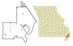
mapsize = 250px
map_caption = Location of Howardville, Missouri
mapsize1 =
map_caption1 =subdivision_type = Country
subdivision_name =United States
subdivision_type1 = State
subdivision_name1 =Missouri
subdivision_type2 = County
subdivision_name2 = New Madrid
government_footnotes =
government_type =
leader_title =
leader_name =
leader_title1 =
leader_name1 =
established_title =
established_date =unit_pref = Imperial
area_footnotes =area_magnitude =
area_total_km2 = 0.6
area_land_km2 = 0.6
area_water_km2 = 0.0
area_total_sq_mi = 0.2
area_land_sq_mi = 0.2
area_water_sq_mi = 0.0population_as_of = 2000
population_footnotes =
population_total = 342
population_density_km2 = 575.3
population_density_sq_mi = 1490.0timezone = Central (CST)
utc_offset = -6
timezone_DST = CDT
utc_offset_DST = -5
elevation_footnotes =
elevation_m = 89
elevation_ft = 292
latd = 36 |latm = 34 |lats = 3 |latNS = N
longd = 89 |longm = 35 |longs = 56 |longEW = Wpostal_code_type =
ZIP code
postal_code = 63869
area_code = 573
blank_name = FIPS code
blank_info = 29-33364GR|2
blank1_name = GNIS feature ID
blank1_info = 0719923GR|3
website =
footnotes =Howardville is a city in New Madrid County,
Missouri ,United States . The population was 342 at the 2000 census.History
The town was founded by Travis Howard, the father of
Elston Howard . [http://www.afrigeneas.com/preciousphotos/photo009.htm]Geography
Howardville is located at coor dms|36|34|3|N|89|35|56|W|city (36.567455, -89.598924)GR|1.
According to the
United States Census Bureau , the city has a total area of 0.2square mile s (0.6km² ), all of it land.New Madrid County Central High School andNew Madrid County Central Middle School are located hereDemographics
As of the
census GR|2 of 2000, there were 342 people, 133 households, and 88 families residing in the city. Thepopulation density was 1,490.0 people per square mile (574.1/km²). There were 158 housing units at an average density of 688.4/sq mi (265.2/km²). The racial makeup of the city was 7.02% White, 92.40% African American, and 0.58% from two or more races. Hispanic or Latino of any race were 1.46% of the population.There were 133 households out of which 36.1% had children under the age of 18 living with them, 18.8% were married couples living together, 39.8% had a female householder with no husband present, and 33.8% were non-families. 31.6% of all households were made up of individuals and 15.8% had someone living alone who was 65 years of age or older. The average household size was 2.57 and the average family size was 3.23.
In the city the population was spread out with 33.9% under the age of 18, 13.2% from 18 to 24, 22.8% from 25 to 44, 17.0% from 45 to 64, and 13.2% who were 65 years of age or older. The median age was 27 years. For every 100 females there were 82.9 males. For every 100 females age 18 and over, there were 69.9 males.
The median income for a household in the city was $9,671, and the median income for a family was $11,389. Males had a median income of $23,750 versus $16,023 for females. The
per capita income for the city was $6,588. About 63.0% of families and 58.5% of the population were below thepoverty line , including 69.4% of those under age 18 and 73.0% of those age 65 or over.References
External links
Wikimedia Foundation. 2010.