- Verona, Missouri
Infobox Settlement
official_name = Verona, Missouri
settlement_type =Town
nickname =
motto =
imagesize =
image_caption =
image_
imagesize =
image_caption =
image_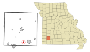
mapsize = 250px
map_caption = Location of Verona, Missouri
mapsize1 =
map_caption1 =subdivision_type = Country
subdivision_name =United States
subdivision_type1 = State
subdivision_name1 =Missouri
subdivision_type2 = County
subdivision_name2 = Lawrence
government_footnotes =
government_type =
leader_title =
leader_name =
leader_title1 =
leader_name1 =
established_title =
established_date =unit_pref = Imperial
area_footnotes =area_magnitude =
area_total_km2 = 2.3
area_land_km2 = 2.3
area_water_km2 = 0.0
area_total_sq_mi = 0.9
area_land_sq_mi = 0.9
area_water_sq_mi = 0.0population_as_of = 2000
population_footnotes =
population_total = 714
population_density_km2 = 316.7
population_density_sq_mi = 820.3timezone = Central (CST)
utc_offset = -6
timezone_DST = CDT
utc_offset_DST = -5
elevation_footnotes =
elevation_m = 390
elevation_ft = 1280
latd = 36 |latm = 57 |lats = 47 |latNS = N
longd = 93 |longm = 47 |longs = 44 |longEW = Wpostal_code_type =
ZIP code
postal_code = 65769
area_code = 417
blank_name = FIPS code
blank_info = 29-75886GR|2
blank1_name = GNIS feature ID
blank1_info = 0728175GR|3
website =
footnotes =Verona is a city in Lawrence County,
Missouri ,United States . The population was 714 at the 2000 census, at which time it was a town.Geography
Verona is located at coor dms|36|57|47|N|93|47|44|W|city (36.963034, -93.795626)GR|1.
According to the
United States Census Bureau , the town has a total area of 0.9square mile s (2.3km² ), all of it land.Lore
Along with Verona Beach, a popular party area for the teenagers of the region, Verona is famous in the Southwest Missouri area for its haunted cemetery (Lee Cemetery) as well as rumored satanic cult activities around the town. the infamous verona church was burned down a few years ago, and since, rumors of satanic activities are starting to become more associated with legends rather than facts.
Demographics
As of the
census GR|2 of 2000, there were 714 people, 238 households, and 170 families residing in the town. Thepopulation density was 820.3 people per square mile (316.9/km²). There were 252 housing units at an average density of 289.5/sq mi (111.8/km²). The racial makeup of the town was 79.41% White, 1.54% African American, 0.70% Native American, 0.28% Asian, 16.39% from other races, and 1.68% from two or more races. Hispanic or Latino of any race were 30.95% of the population.There were 238 households out of which 35.7% had children under the age of 18 living with them, 54.2% were married couples living together, 10.9% had a female householder with no husband present, and 28.2% were non-families. 23.1% of all households were made up of individuals and 13.4% had someone living alone who was 65 years of age or older. The average household size was 3.00 and the average family size was 3.52.
In the town the population was spread out with 31.1% under the age of 18, 10.2% from 18 to 24, 27.3% from 25 to 44, 21.6% from 45 to 64, and 9.8% who were 65 years of age or older. The median age was 31 years. For every 100 females there were 96.2 males. For every 100 females age 18 and over, there were 96.0 males.
The median income for a household in the town was $27,813, and the median income for a family was $30,156. Males had a median income of $21,250 versus $16,442 for females. The
per capita income for the town was $11,750. About 19.4% of families and 26.4% of the population were below thepoverty line , including 36.6% of those under age 18 and 12.2% of those age 65 or over.References
External links
Wikimedia Foundation. 2010.