- Mirigama
-
Mirigama
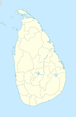
මීරිගමLocation of Mirigama Coordinates: 7°14′29″N 80°7′57″E / 7.24139°N 80.1325°E Country  Sri Lanka
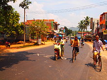
Province Western Province, Sri Lanka Mirigama is a town in Gampaha District, Sri Lanka. It is located 57 km from Colombo, and 35 km from Bandaranaike International Airport.
It is one of the most populated and fastest growing cities in the country and is a major metro.
Mirigama is also spelled as Meerigama.
Mirigama has direct rail and highway connections to many cities in the country.
Mirigama is the hometown of Sri Lanka's first Prime Minister D.S. Senanayake .
SLAF Mirigama, a premier radar station of Sri Lanka Air Force is situated in Mirigama suburbs.
Web site : Meerigama.com [1] Meerigama Online Community.
www.mirigama.co.cc - Facebook
Schools
- Dudley Senanayake Adarsha Kanishta Vidyalaya
(Now Dudley Senanayake Adarsha Maha Vidyalaya)
- D.S.Senanayake Central College
- Bandaranayake Vidyalaya
Links
Coordinates: 7°14′29″N 80°7′57″E / 7.24139°N 80.1325°E
Categories:- Western Province, Sri Lanka geography stubs
- Populated places in Western Province, Sri Lanka
- Gampaha District
Wikimedia Foundation. 2010.


