Loch Cluanie

Loch Cluanie
Loch Cluanie
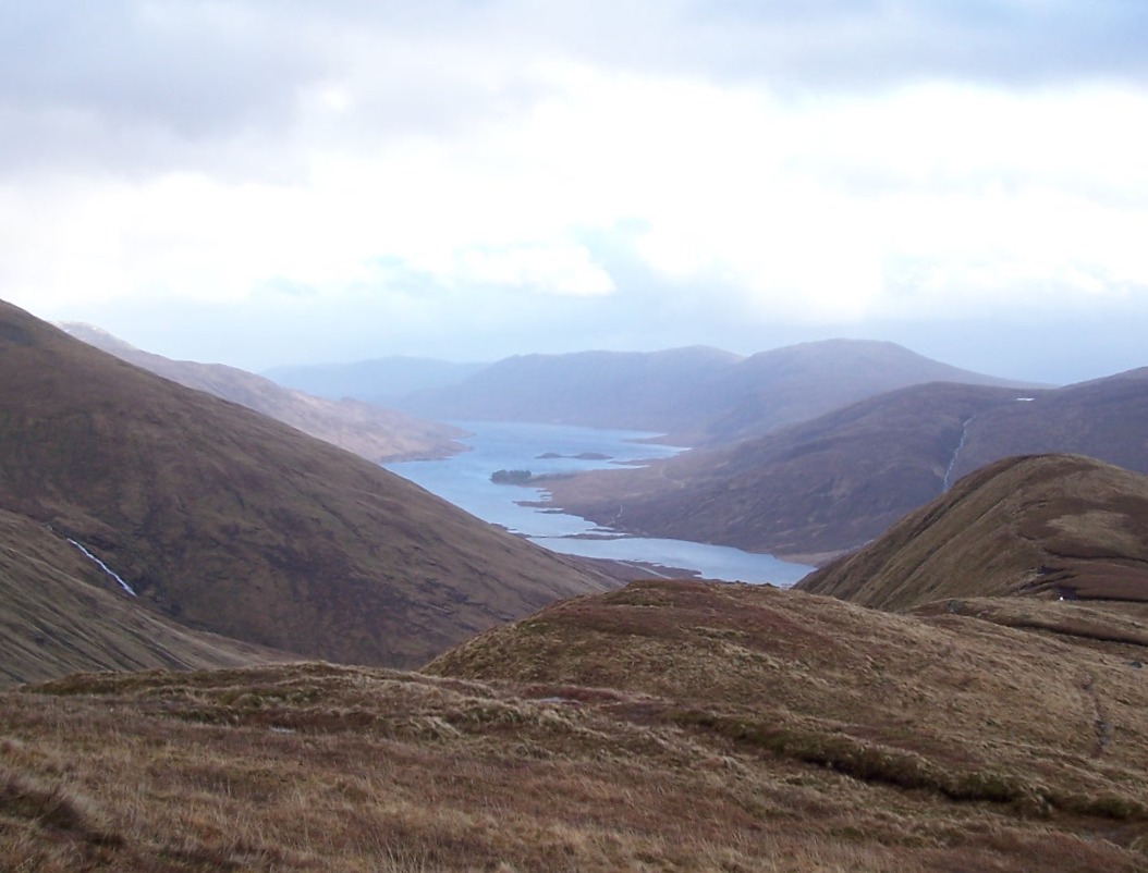
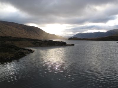
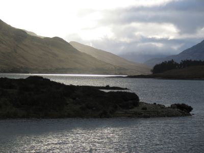
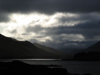
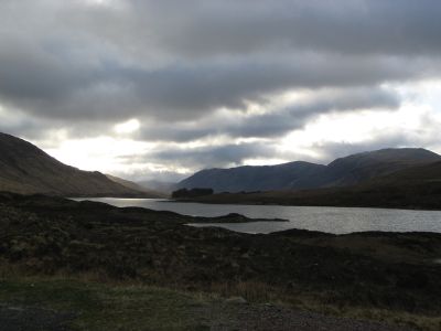
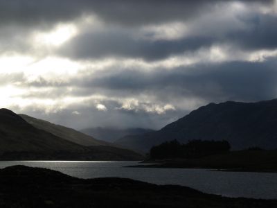
Loch Cluanie and Beinn Loinne seen from Meall a' Charra
Location Northwest Highlands, Scotland
Coordinates 57°8′40″N 5°5′30″W / 57.14444°N 5.09167°W / 57.14444; -5.09167Coordinates: 57°8′40″N 5°5′30″W / 57.14444°N 5.09167°W / 57.14444; -5.09167
Lake type reservoir
Basin countries United Kingdom

Loch Cluanie (Scottish Gaelic: Loch Cluanaidh) is a loch in the Northwest Highlands of Scotland at the south-east end of Glen Shiel. It is a reservoir, contained behind the Cluanie Dam, constructed by Mitchell Construction and completed in 1957 as part of the North of Scotland Hydro-Electric Board's Glenmoriston project to generate hydroelectricity.[1] The dam is also the home of the free (illegal) music festival Midge Death held annually at the end of September.

The hamlet of Cluanie is on the west side of the loch. It has a car park, the Cluanie Inn and two houses which are used as "holiday homes" by their owners. The A87 road runs along the north edge of the loch. Cluanie Lodge (NH097109) is a private dewlling owned by the estate and land owner, again used as a holiday home, on the south-west corner of the loch. The richly vegetated areas at the side of the loch are home to small birds such as the willow warbler and the wren.

Gallery

Loch Cluanie from the dam near the Cluanie Inn.
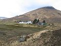

References

  1. ^ Indictment: Power & Politics in the Construction Industry, David Morrell, Faber & Faber, 1987, ISBN 978-0571149858

External links


Wikimedia Foundation. 2010.

Игры ⚽ Поможем написать курсовую

Look at other dictionaries:

  • Loch Cluanie — Abflüsse …   Deutsch Wikipedia

  • Loch Cluanie — Sp Klùnio ẽžeras Ap Loch Cluanie angliškai, geliškai (škotiškai) Sp Lòch Klùnis Ap Loch Cluanie angliškai, geliškai (škotiškai) L Jungtinėje Karalystėje (Škotijoje) …   Pasaulio vietovardžiai. Internetinė duomenų bazė

  • Liste schottischer Lochs — Loch ist das schottisch gälische Wort für einen See oder eine Meeresbucht, einen Fjord (englisch Firth). Das Wort, lɔx, «loch» mit kehligem «ch» ausgesprochen, ist verwandt mit dem altirischen Lough, rekonstruierte indogermanische Wurzel… …   Deutsch Wikipedia

  • Am Bathach — Infobox Mountain Name = Am Bathach Photo = Am Bathach from Ciste Dhubh.jpg Caption = Am Bathach seen from Ciste Dhubh, 2.5 km to the north. Elevation = 798 m (2618 ft) Location = Kintail, Highland SCO Range = Northwest Highlands Prominence = 231… …   Wikipedia

  • Ciste Dhubh — seen from the Corbett Am Bàthach, three km to the south. Elevation …   Wikipedia

  • Aonach Meadhoin — Infobox Mountain Name = Aonach Meadhoin Photo = Aonach Meadhoin from Sgurr a Bhealaich Dheirg.jpg Caption = Aonach Meadhoin (right) and Sgurr an Fhuarail (left) from Sgurr a Bhealaich Dheirg. Two km to the NW. Elevation = 1001 m (3284 ft)… …   Wikipedia

  • A87 road — UK road routebox road= A87 length mi= length km= direction= East to west start= Invergarry (gbmappingsmall|NH307011) destinations= end= Uig (gbmappingsmall|NG385635) construction date= completion date= junctions= ukroadsmall|82… …   Wikipedia

  • A' Chràlaig — Infobox Mountain Name = A Chràlaig Photo = A Chralaig2 06 07 048.jpg Caption = A Chralaig from Aonach Meadhoin Elevation = 1,120 m (3,674 ft) Prominence = 786 m Ranked 38th in British Isles Parent peak = Carn Eige Location = Highland, SCO Range …   Wikipedia

  • Klunio ežeras — Sp Klùnio ẽžeras Ap Loch Cluanie angliškai, geliškai (škotiškai) Sp Lòch Klùnis Ap Loch Cluanie angliškai, geliškai (škotiškai) L Jungtinėje Karalystėje (Škotijoje) …   Pasaulio vietovardžiai. Internetinė duomenų bazė

  • Liste des lochs d'Écosse — Ce qui suit est une liste des lochs d Écosse. Cette liste est loin d être exhaustive: seuls les plus connus sont répertoriés. Il a été estimé qu il y a au moins 31 460 lacs d eau douce en Écosse, et plus de 7 500 dans les Hébrides extérieures… …   Wikipédia en Français

Share the article and excerpts

Direct link
Do a right-click on the link above
and select “Copy Link”