- Rothville, Missouri
Infobox Settlement
official_name = Rothville, Missouri
settlement_type = Village
nickname =
motto =
imagesize =
image_caption =
image_
imagesize =
image_caption =
image_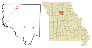
mapsize = 250x200px
map_caption = Location of Rothville, Missouri
mapsize1 =
map_caption1 =subdivision_type = Country
subdivision_name =United States
subdivision_type1 = State
subdivision_name1 =Missouri
subdivision_type2 = County
subdivision_name2 = Chariton
government_footnotes =
government_type =
leader_title =
leader_name =
leader_title1 =
leader_name1 =
established_title =
established_date =unit_pref = Imperial
area_footnotes =area_magnitude =
area_total_km2 = 0.7
area_land_km2 = 0.7
area_water_km2 = 0.0
area_total_sq_mi = 0.3
area_land_sq_mi = 0.3
area_water_sq_mi = 0.0population_as_of = 2000
population_footnotes =
population_total = 93
population_density_km2 = 143.0
population_density_sq_mi = 370.3timezone = Central (CST)
utc_offset = -6
timezone_DST = CDT
utc_offset_DST = -5
elevation_footnotes =
elevation_m = 226
elevation_ft = 741
latd = 39 |latm = 39 |lats = 17 |latNS = N
longd = 93 |longm = 3 |longs = 40 |longEW = Wpostal_code_type =
ZIP code
postal_code = 64676
area_code = 660
blank_name = FIPS code
blank_info = 29-63236GR|2
blank1_name = GNIS feature ID
blank1_info = 0725590GR|3
website =
footnotes =Rothville is a village in Chariton County,
Missouri ,United States . The population was 93 at the 2000 census.Geography
Rothville is located at coor dms|39|39|17|N|93|3|40|W|city (39.654715, -93.061086)GR|1.
According to the
United States Census Bureau , the village has a total area of 0.2square mile s (0.6km² ), all of it land.Demographics
As of the
census GR|2 of 2000, there were 93 people, 39 households, and 23 families residing in the village. Thepopulation density was 370.3 people per square mile (143.6/km²). There were 48 housing units at an average density of 191.1/sq mi (74.1/km²). The racial makeup of the village was 98.92% White, and 1.08% from two or more races.There were 39 households out of which 33.3% had children under the age of 18 living with them, 48.7% were married couples living together, 7.7% had a female householder with no husband present, and 38.5% were non-families. 35.9% of all households were made up of individuals and 17.9% had someone living alone who was 65 years of age or older. The average household size was 2.38 and the average family size was 3.13.
In the village the population was spread out with 24.7% under the age of 18, 8.6% from 18 to 24, 34.4% from 25 to 44, 16.1% from 45 to 64, and 16.1% who were 65 years of age or older. The median age was 40 years. For every 100 females there were 106.7 males. For every 100 females age 18 and over, there were 100.0 males.
The median income for a household in the village was $26,786, and the median income for a family was $27,917. Males had a median income of $26,563 versus $18,125 for females. The
per capita income for the village was $10,226. There were 7.4% of families and 10.8% of the population living below thepoverty line , including 14.3% of under eighteens and none of those over 64.History
Little
Laura Ingalls Wilder with her family, aunt Polly Melona Ingalls and uncle Henry Odin Quiner with their children moved here in1868 . Laura's family left the place in1869 . And so did Polly and Henry soon.References
"IT" the clown figure was once spotted floating down yellow creek with his stuffed baby doll External links
Wikimedia Foundation. 2010.