- Thaxton, Mississippi
Infobox Settlement
official_name = Thaxton, Mississippi
settlement_type =Town
nickname =
motto =
imagesize =
image_caption =
image_
imagesize =
image_caption =
image_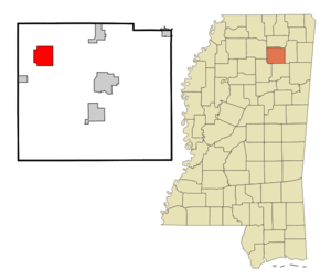
mapsize = 250px
map_caption = Location of Thaxton, Mississippi
mapsize1 =
map_caption1 =subdivision_type = Country
subdivision_name =United States
subdivision_type1 = State
subdivision_name1 =Mississippi
subdivision_type2 = County
subdivision_name2 = Pontotoc
government_footnotes =
government_type =
leader_title =
leader_name =
leader_title1 =
leader_name1 =
established_title =
established_date =unit_pref = Imperial
area_footnotes =area_magnitude =
area_total_km2 = 22.1
area_land_km2 = 22.0
area_water_km2 = 0.1
area_total_sq_mi = 8.5
area_land_sq_mi = 8.5
area_water_sq_mi = 0.0population_as_of = 2000
population_footnotes =
population_total = 513
population_density_km2 = 23.3
population_density_sq_mi = 60.4timezone = Central (CST)
utc_offset = -6
timezone_DST = CDT
utc_offset_DST = -5
elevation_footnotes =
elevation_m = 128
elevation_ft = 420
latd = 34 |latm = 18 |lats = 11 |latNS = N
longd = 89 |longm = 10 |longs = 19 |longEW = Wpostal_code_type =
ZIP code
postal_code = 38871
area_code = 662
blank_name = FIPS code
blank_info = 28-72760
blank1_name = GNIS feature ID
blank1_info = 0694959
website =
footnotes =Thaxton is a town in Pontotoc County,
Mississippi ,United States . The population was 513 at the 2000 census. There is a town of the same name in Virginia (seeThaxton, Virginia )Geography
Thaxton is located at coor dms|34|18|11|N|89|10|19|W|city (34.302923, -89.171979)GR|1.
According to the
United States Census Bureau , the town has a total area of 8.5square mile s (22.1km² ), of which, 8.5 square miles (22.0 km²) of it is land and 0.04 square miles (0.1 km²) of it (0.47%) is water.Demographics
As of the
census GR|2 of 2000, there were 513 people, 173 households, and 146 families residing in the town. Thepopulation density was 60.4 people per square mile (23.3/km²). There were 192 housing units at an average density of 22.6/sq mi (8.7/km²). The racial makeup of the town was 99.22% White and 0.78% African American. Hispanic or Latino of any race were 1.17% of the population.There were 173 households out of which 49.7% had children under the age of 18 living with them, 72.8% were married couples living together, 8.1% had a female householder with no husband present, and 15.6% were non-families. 12.1% of all households were made up of individuals and 7.5% had someone living alone who was 65 years of age or older. The average household size was 2.97 and the average family size was 3.22.
In the town the population was spread out with 29.4% under the age of 18, 12.3% from 18 to 24, 29.6% from 25 to 44, 19.7% from 45 to 64, and 9.0% who were 65 years of age or older. The median age was 34 years. For every 100 females there were 98.1 males. For every 100 females age 18 and over, there were 94.6 males.
The median income for a household in the town was $41,750, and the median income for a family was $42,250. Males had a median income of $31,528 versus $20,536 for females. The
per capita income for the town was $15,941. About 8.2% of families and 9.2% of the population were below thepoverty line , including 13.7% of those under age 18 and 6.7% of those age 65 or over.Education
The Town of Thaxton is served by the
Pontotoc County School District .References
External links
Wikimedia Foundation. 2010.