- Cerro de Punta
-
Cerro de Punta 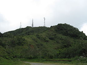
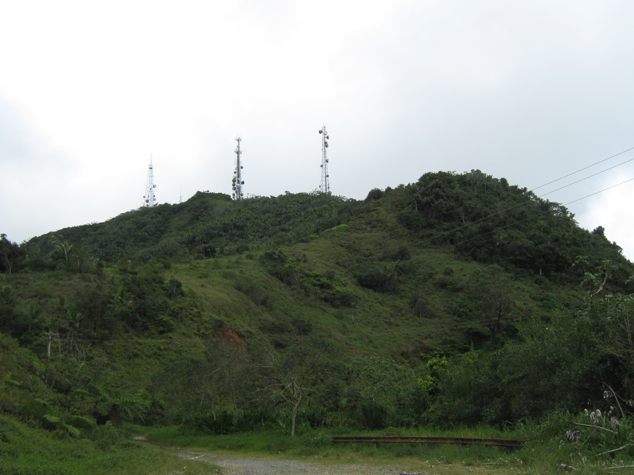
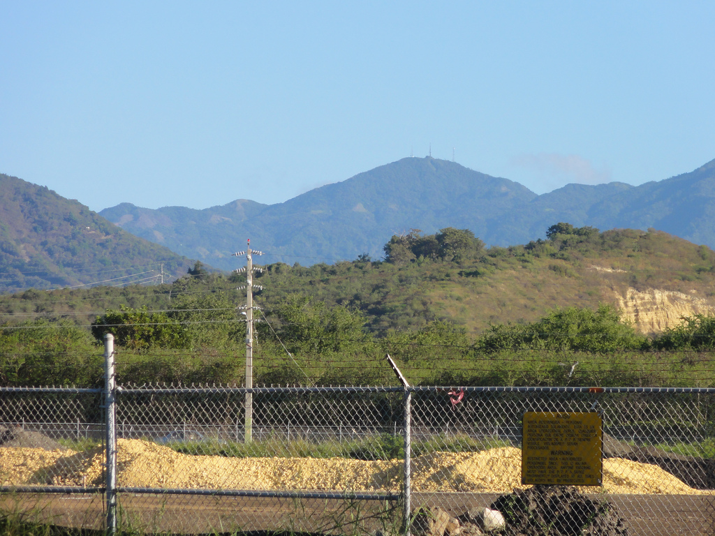
View from Ruta Panorámica, with Cellular network towersElevation 1,338 m (4,390 ft) [1] Location Location of Cerro de Punta in the municipality of Ponce, Puerto Rico, shown as a red triangle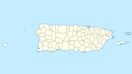
 Cerro de Punta
Range Cordillera Central Coordinates 18°10′21″N 66°35′31″W / 18.1725°N 66.59194°WCoordinates: 18°10′21″N 66°35′31″W / 18.1725°N 66.59194°W Climbing Easiest route Hike Cerro de Punta or just Cerro Punta is the highest peak in Puerto Rico, raising to 1,338 meters (4,390 ft) above sea level. It is located in the municipality of Ponce.[2][3][4][5][6][7]
Contents
Location
The mountain is located in the Cordillera Central, on the border between the municipalities of Jayuya and Ponce.[8] The access road to the point closest to the highest elevation is from the municipality of Jayuya.[9] It is part of the Toro Negro Forest Reserve, and it has been described as "an alpine runt."[10] It is located on the western end of the Toro Negro State Park. The mountain is just north of east-to-westbound Route 143. It is located at coordinates 18.172458 and -66.591839W.[11] The nearest populated place to Cerro de Punta is Urbanization Vega Linda, located 3.3 miles away.[12]
Geology
Unlike many Caribbean mountains, Cerro de Punta is not a volcano but simply the highest point in the Cordillera Central. Cordillera Central is the central mountain range that divides the island by running in an east-west fashion.[13]
Best view
The view from atop Cerro de Punta is said to be "the best view in all of Puerto Rico". On a clear day, it is possible to see virtually the entire island, including as far as San Juan, which is over 75 miles away.[14] There are a number of radio and television transmission and re-transmission towers just off the top of the mountain.[15] There is an observation platform at the top of the mountain.[16]
Wildlife and flora
The mountain is home to an abundant amount wildlife, lush vegetation, flowering shrubs and trees, and numerous waterfalls.[17] The mountain is covered by palm trees.[18] Various plants, including some endangered species are found here.[19] The endangered fern Elaphoglossum serpens is found only on this mountain and nowhere else in the world.[20]
Nearby roads
The area consists of may steep mountains. The nearest road is PR-143, which is a winding two-lane mountain road that must be travelled very slowly as it is not possible to see traffic coming the opposite direction for any significant length. Off Route 143 is the road that actually leads to the mountain's top. Route 143 can be accessed via the better-traveled Route 10.[21] Route 143 is part of the Ruta Panorámica.
Hiking and access trail
A nearby inn called Hacienda Gripiñas, has a trail that leads to the top of the mountain. Hacienda Gripiñas was a coffee plantation, but has been turned into a country inn. It actually still grows some coffee. The inn operates under a contract with the Government of Puerto Rico.[22] The trails, however, are not well marked and often suffer damage from storms.[23] While people can hike their way to the top of the mountain, there is a paved road that leads to the very summit.[24] The Toro Negro Forest Reserve has 12 miles of hiking trails some of which lead to the top of Cerro de Punta.[25]
Gallery
-

Cerro de Punta as seen from Mercedita Airport, Ponce, Puerto Rico
-

Cerro de Punta as seen from Museo de Arte de Ponce, Ponce, Puerto Rico
-
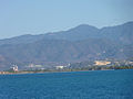
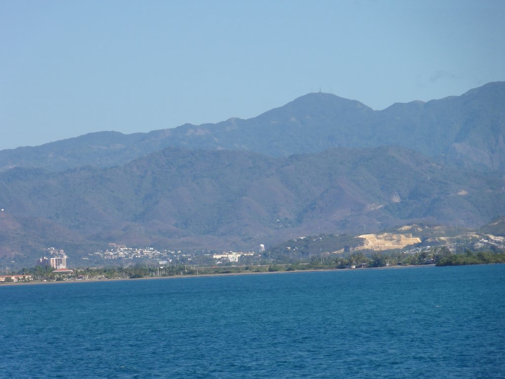
Cerro de Punta as seen from the Caja de Muertos, Ponce, Puerto Rico
References
- ^ "Elevations and Distances in the United States". U.S Geological Survey. 29 April 2005. http://erg.usgs.gov/isb/pubs/booklets/elvadist/elvadist.html#Highest. Retrieved November 9, 2006.
- ^ U.S. Geological Survey. Highest Elevations. Retrieved February 25, 2010.
- ^ "located in the county/subdivision of Ponce District (source: U.S. Geological Survey)" Retrieved March 21, 2010.
- ^ Government of the Commonwealth of Puerto Rico. Office of Management and Budgeting. Government Information and Technology Area. Geographic Information Systems Unit. General Purpose Population Data, Census 2000. Retrieved March 21, 2010.
- ^ Ponce Topographic Map. Map Styles: Map and Shaded. Trails.com. From: United States Geological Survey. Topo Map. Projection: NAD83/WGS84. Retrieved February 22, 2010.
- ^ Mountainzone.com: Ponce County, Puerto Rico, Mountain Peaks & Summits.
- ^ Puerto Rico Physical Features: Summits. PR Home Town Locator. United States Geological Survey. Retrieved 7 June 2011.
- ^ US Geological Survey
- ^ Government of Puerto Rico. General Purpose Population Data, Census 2000. Unidad de Sistemas de Información Geográfica, Área de Tecnología de Información Gubernamental, Oficina de Gerencia y Presupuesto. Retrieved March 21, 2010.
- ^ M. Timothy O'Keefe. Cerro de Punta Climb, Puerto Rico, Part 1. Puerto Rico's highest mountain, and one no one seems to climb. Guide To Caribbean Vacations, Caribbean Travel Tips & Tourist Information.
- ^ Cerro de Punta Summit - Puerto Rico Mountain Peak Information
- ^ Cerro de Punta Summit - Puerto Rico Mountain Peak Information
- ^ The Puerto Rico Channel. Cerro de Punta: the High Point of Puerto Rico.
- ^ Cerro de Punta:the High Point of Puerto Rico. By The Puerto Rico Channel.
- ^ Brandon Stephens, Marion Smith, and Alan Cressler. Cerro de Punta. Published by Brian Killingbeck. ©2005
- ^ Planetware: Your Unlimited Travel Guide to the World.
- ^ The Puerto Rico Channel. Cerro de Punta:the High Point of Puerto Rico.
- ^ Brandon Stephens, Marion Smith, and Alan Cressler. Cerro de Punta. Published by Brian Killingbeck. ©2005
- ^ Maxon & Morton ex Maxon. U.S. Department of Agriculture. Elaphoglossum serpens At Cerro de Punta, Jayuya.
- ^ USFWS. Recovery Plan for Puerto Rican Endangered Ferns (7 spp.). January 1995.
- ^ Brandon Stephens, Marion Smith, and Alan Cressler. Cerro de Punta. Published by Brian Killingbeck. ©2005
- ^ The Puerto Rico Channel. Cerro de Punta: the High Point of Puerto Rico.
- ^ The Puerto Rico Channel. Cerro de Punta: the High Point of Puerto Rico.
- ^ M. Timothy O'Keefe. Cerro de Punta Climb, Puerto Rico, Part 1. Puerto Rico's highest mountain, and one no one seems to climb. Guide To Caribbean Vacations, Caribbean Travel Tips & Tourist Information.
- ^ M. Timothy O'Keefe. Cerro de Punta Climb, Puerto Rico, Part 1. Puerto Rico's highest mountain, and one no one seems to climb. Guide To Caribbean Vacations, Caribbean Travel Tips & Tourist Information.
External links
Categories:- Mountains of Puerto Rico
- Mountains of the Caribbean
- Highpoints in the Caribbean
- Jayuya, Puerto Rico
- Ponce, Puerto Rico
-


Wikimedia Foundation. 2010.