- Wing River Township, Wadena County, Minnesota
Infobox Settlement
official_name = Wing River Township, Minnesota
settlement_type = Township
nickname =
motto =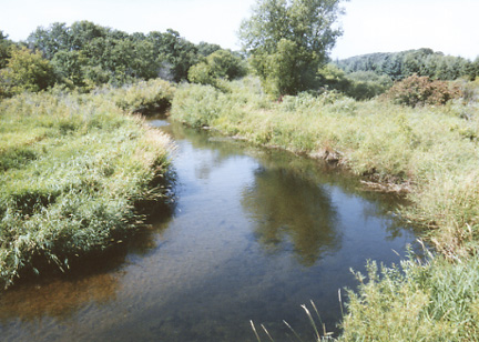
imagesize = 250px
image_caption = The Wing River for which the township is named, as pictured near Verndale
image_|pushpin_
pushpin_label_position =left
pushpin_map_caption =Location within the state of Minnesota
pushpin_mapsize =
|mapsize =
map_caption =
mapsize1 =
map_caption1 =subdivision_type = Country
subdivision_name =United States
subdivision_type1 = State
subdivision_name1 =Minnesota
subdivision_type2 = County
subdivision_name2 = Wadenagovernment_footnotes =
government_type =
leader_title =
leader_name =
leader_title1 =
leader_name1 =
established_title =
established_date =unit_pref = Imperial
area_footnotes =area_magnitude =
area_total_km2 = 93.3
area_land_km2 = 93.3
area_water_km2 = 0.1
area_total_sq_mi = 36.0
area_land_sq_mi = 36.0
area_water_sq_mi = 0.0population_as_of = 2000
population_footnotes =
population_total = 430
population_density_km2 = 4.6
population_density_sq_mi = 11.9timezone = Central (CST)
utc_offset = -6
timezone_DST = CDT
utc_offset_DST = -5
elevation_footnotes =
elevation_m = 397
elevation_ft = 1302
latd = 46 |latm = 30 |lats = 12 |latNS = N
longd = 94 |longm = 58 |longs = 43 |longEW = Wpostal_code_type =
ZIP code
postal_code = 56481
area_code = 218
blank_name = FIPS code
blank_info = 27-70906GR|2
blank1_name = GNIS feature ID
blank1_info = 0666020GR|3
website =
footnotes =Wing River Township is a township in Wadena County,
Minnesota ,United States . The population was 430 at the 2000 census. It is named for the Wing River, which joins the Leaf River in the township.Geography
According to the
United States Census Bureau , the township has a total area of 36.0square mile s (93.3km² ), of which, 36.0 square miles (93.3 km²) of it is land and 0.04 square miles (0.1 km²) of it (0.06%) is water.Demographics
As of the
census GR|2 of 2000, there were 430 people, 166 households, and 122 families residing in the township. Thepopulation density was 11.9 people per square mile (4.6/km²). There were 196 housing units at an average density of 5.4/sq mi (2.1/km²). The racial makeup of the township was 98.84% White, 0.23% African American, 0.23% Native American, 0.70% from other races. Hispanic or Latino of any race were 0.70% of the population.There were 166 households out of which 30.1% had children under the age of 18 living with them, 66.9% were married couples living together, 4.2% had a female householder with no husband present, and 26.5% were non-families. 22.3% of all households were made up of individuals and 10.2% had someone living alone who was 65 years of age or older. The average household size was 2.59 and the average family size was 3.05.
In the township the population was spread out with 25.1% under the age of 18, 8.1% from 18 to 24, 21.4% from 25 to 44, 29.5% from 45 to 64, and 15.8% who were 65 years of age or older. The median age was 42 years. For every 100 females there were 102.8 males. For every 100 females age 18 and over, there were 109.1 males.
The median income for a household in the township was $35,469, and the median income for a family was $39,063. Males had a median income of $29,375 versus $26,250 for females. The
per capita income for the township was $13,634. About 3.7% of families and 7.3% of the population were below thepoverty line , including 9.9% of those under age 18 and 5.5% of those age 65 or over.References

Wikimedia Foundation. 2010.