- Browns Valley, Minnesota
Infobox Settlement
official_name = Browns Valley, Minnesota
settlement_type =City
nickname =
motto =
imagesize =
image_caption =
image_
imagesize =
image_caption =
image_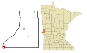
mapsize = 250px
map_caption = Location of Browns Valley, Minnesota
mapsize1 =
map_caption1 =subdivision_type = Country
subdivision_name =United States
subdivision_type1 = State
subdivision_name1 =Minnesota
subdivision_type2 = County
subdivision_name2 = Traversegovernment_footnotes =
government_type =
leader_title =
leader_name =
leader_title1 =
leader_name1 =
established_title =
established_date =unit_pref = Imperial
area_footnotes =area_magnitude =
area_total_km2 = 2.0
area_land_km2 = 2.0
area_water_km2 = 0.0
area_total_sq_mi = 0.8
area_land_sq_mi = 0.8
area_water_sq_mi = 0.0population_as_of = 2000
population_footnotes =
population_total = 690
population_density_km2 = 339.2
population_density_sq_mi = 878.5timezone = Central (CST)
utc_offset = -6
timezone_DST = CDT
utc_offset_DST = -5
elevation_footnotes =
elevation_m = 301
elevation_ft = 988
latd = 45 |latm = 35 |lats = 41 |latNS = N
longd = 96 |longm = 49 |longs = 54 |longEW = Wpostal_code_type =
ZIP code
postal_code = 56219
area_code = 320
blank_name = FIPS code
blank_info = 27-08200GR|2
blank1_name = GNIS feature ID
blank1_info = 0659752GR|3
website =
footnotes =Browns Valley is a city in Traverse County,
Minnesota ,United States , adjacent to theSouth Dakota border. The population was 690 at the 2000 census. Browns Valley lies along theLittle Minnesota River between the northern end ofBig Stone Lake and the southern end ofLake Traverse , which is separated from the Little Minnesota River by a low and narrowcontinental divide that skirts the northern edge of town. The city, both lakes, and the river lie in theTraverse Gap , the bed of ancientGlacial River Warren , the outlet toGlacial Lake Agassiz which, when drained, became the valley of theRed River of the North .Geography
According to the
United States Census Bureau , the city has a total area of 0.8square mile s (2.0km² ), all of it land.The Browns Valley weather station often records some of Minnesota's highest summer temperatures. For example, on July 31, 2007, a high of 107°F (42°C) was registered Cite web|url=http://climate.umn.edu/weathertalk/060804.txt|title=Minnesota WeatherTalk for Friday, August 4, 2006|accessdate=2007-07-21|year=2006|author=Mark Seeley] .
Minnesota Highways 27 and 28 are two of the main routes in the community.
Demographics
As of the
census GR|2 of 2000, there were 690 people, 285 households, and 171 families residing in the city. Thepopulation density was 878.5 people per square mile (337.2/km²). There were 317 housing units at an average density of 403.6/sq mi (154.9/km²). The racial makeup of the city was 82.61% White, 15.80% Native American, 0.43% Asian, 0.14% Pacific Islander, 0.14% from other races, and 0.87% from two or more races. Hispanic or Latino of any race were 1.74% of the population.There were 285 households out of which 26.3% had children under the age of 18 living with them, 45.3% were married couples living together, 9.5% had a female householder with no husband present, and 40.0% were non-families. 36.5% of all households were made up of individuals and 21.4% had someone living alone who was 65 years of age or older. The average household size was 2.29 and the average family size was 3.02.
In the city the population was spread out with 24.5% under the age of 18, 7.4% from 18 to 24, 17.8% from 25 to 44, 19.3% from 45 to 64, and 31.0% who were 65 years of age or older. The median age was 45 years. For every 100 females there were 86.5 males. For every 100 females age 18 and over, there were 82.2 males.
The median income for a household in the city was $26,563, and the median income for a family was $30,208. Males had a median income of $25,500 versus $20,139 for females. The
per capita income for the city was $15,062. About 10.3% of families and 14.4% of the population were below thepoverty line , including 16.5% of those under age 18 and 11.0% of those age 65 or over.Flooding
In March 2007, Browns Valley was flooded from the north and west by the
Little Minnesota River . 100 people had to be evacuated from their homes, a significant percentage of the town's population. [cite news
last = Post
first = Tim
coauthors =
title = Flood recedes but tempers rise in Browns Valley
work = News and Features
pages =
language =
publisher = Minnesota Public Radio
date = 2007-03-15
url = http://minnesota.publicradio.org/display/web/2007/03/15/brownsvalleyday2/
accessdate = 2007-06-02 ] The damage was significant enough to warrant a visit from GovernorTim Pawlenty and CongressmanCollin Peterson . [cite news
last = Post
first = Tim
coauthors =
title = Pawlenty and Peterson tour Browns Valley
work = News and Features
pages =
language =
publisher = Minnesota Public Radio
date = 2007-03-16
url = http://minnesota.publicradio.org/display/web/2007/03/16/govebrownsvalley/
accessdate = 2007-06-02 ]References
External links
* cite web
last =
first =
authorlink =
coauthors =
title =Browns Valley, MN Spring 2007
work =Flooding
publisher =JOR Engineering, Inc.
date = 2007-03-14
url = http://www.joreng.com/f_bv_3_07.htm
format =
doi =
accessdate = 2007-05-10 Aerial photographs of March 2007 flooding of Traverse Gap, showing flooding of Browns Valley.
Wikimedia Foundation. 2010.