- Rockville, Minnesota
Infobox Settlement
official_name = Rockville, Minnesota
settlement_type =City
nickname =
motto =
imagesize =
image_caption =
image_
imagesize =
image_caption =
image_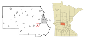
mapsize = 250px
map_caption = Location of Rockville, Minnesota
mapsize1 =
map_caption1 =subdivision_type = Country
subdivision_name =United States
subdivision_type1 = State
subdivision_name1 =Minnesota
subdivision_type2 = County
subdivision_name2 = Stearnsgovernment_footnotes =
government_type =
leader_title =
leader_name =
leader_title1 =
leader_name1 =
established_title =
established_date =unit_pref = Imperial
area_footnotes =area_magnitude =
area_total_km2 = 1.7
area_land_km2 = 1.7
area_water_km2 = 0.0
area_total_sq_mi = 0.7
area_land_sq_mi = 0.7
area_water_sq_mi = 0.0population_as_of = 2000
population_footnotes =
population_total = 749
population_density_km2 = 440.4
population_density_sq_mi = 1140.7timezone = Central (CST)
utc_offset = -6
timezone_DST = CDT
utc_offset_DST = -5
elevation_footnotes =
elevation_m = 328
elevation_ft = 1076
latd = 45 |latm = 28 |lats = 21 |latNS = N
longd = 94 |longm = 20 |longs = 24 |longEW = Wpostal_code_type =
ZIP code
postal_code = 56369
area_code = 320
blank_name = FIPS code
blank_info = 27-55078GR|2
blank1_name = GNIS feature ID
blank1_info = 0650208GR|3
website = [http://www.rockvillecity.org/ www.rockvillecity.org]
footnotes =Rockville is a city in Stearns County,
Minnesota ,United States . The population was 749 at the 2000 census. It is part of the St. Cloud Metropolitan Statistical Area.On
1 June 2002 , the city of Pleasant Lake and Rockville Township were merged into the city of Rockville. [ [http://www.census.gov/popest/geographic/boundary_changes/geo3.php Population Estimates Geographic Change Notes: Minnesota] ,2006-05-19 . Accessed2008-05-28 .]Geography
According to the
United States Census Bureau , the city has a total area of 0.7square mile s (1.7km² ), all of it land.Minnesota State Highway 23 serves as a main route in the city, andInterstate 94 is nearby.Demographics
As of the
census GR|2 of 2000, there were 749 people, 268 households, and 187 families residing in the city. Thepopulation density was 1,140.7 people per square mile (438.2/km²). There were 281 housing units at an average density of 427.9/sq mi (164.4/km²). The racial makeup of the city was 94.53% White, 1.34% African American, 0.13% Native American, 3.20% from other races, and 0.80% from two or more races. Hispanic or Latino of any race were 6.54% of the population.There were 268 households out of which 44.8% had children under the age of 18 living with them, 58.2% were married couples living together, 7.1% had a female householder with no husband present, and 30.2% were non-families. 23.1% of all households were made up of individuals and 6.3% had someone living alone who was 65 years of age or older. The average household size was 2.79 and the average family size was 3.33.
In the city the population was spread out with 31.5% under the age of 18, 11.1% from 18 to 24, 37.0% from 25 to 44, 13.9% from 45 to 64, and 6.5% who were 65 years of age or older. The median age was 29 years. For every 100 females there were 106.3 males. For every 100 females age 18 and over, there were 113.8 males.
The median income for a household in the city was $43,854, and the median income for a family was $50,083. Males had a median income of $31,964 versus $22,000 for females. The
per capita income for the city was $16,527. About 2.1% of families and 4.8% of the population were below thepoverty line , including 3.0% of those under age 18 and none of those age 65 or over.References
External links
* [http://www.rockvillecity.org City website]
Wikimedia Foundation. 2010.