- Fairfax, Minnesota
Infobox Settlement
official_name = Fairfax, Minnesota
settlement_type =City
nickname =
motto =
imagesize =
image_caption =
image_
imagesize =
image_caption =
image_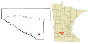
mapsize = 250px
map_caption = Location of Fairfax, Minnesota
mapsize1 =
map_caption1 =subdivision_type = Country
subdivision_name =United States
subdivision_type1 = State
subdivision_name1 =Minnesota
subdivision_type2 = County
subdivision_name2 = Renvillegovernment_footnotes =
government_type =
leader_title =
leader_name =
leader_title1 =
leader_name1 =
established_title =
established_date =unit_pref = Imperial
area_footnotes =area_magnitude =
area_total_km2 = 3.3
area_land_km2 = 3.3
area_water_km2 = 0.0
area_total_sq_mi = 1.3
area_land_sq_mi = 1.3
area_water_sq_mi = 0.0population_as_of = 2000
population_footnotes =
population_total = 1295
population_density_km2 = 388.6
population_density_sq_mi = 1006.6timezone = Central (CST)
utc_offset = -6
timezone_DST = CDT
utc_offset_DST = -5
elevation_footnotes =
elevation_m = 315
elevation_ft = 1033
latd = 44 |latm = 31 |lats = 35 |latNS = N
longd = 94 |longm = 43 |longs = 12 |longEW = Wpostal_code_type =
ZIP code
postal_code = 55332
area_code = 507
blank_name = FIPS code
blank_info = 27-20222GR|2
blank1_name = GNIS feature ID
blank1_info = 0643498GR|3
website =
footnotes =Fairfax is a city in Renville County,
Minnesota ,United States . The population was 1,295 at the 2000 census.Minnesota State Highways 4 and 19 are two of the main arterial routes in the city.
Fort Ridgely State Park is nearby.Geography
According to the
United States Census Bureau , the city has a total area of 1.3square mile s (3.3km² ), all of it land.Demographics
As of the
census GR|2 of 2000, there were 1,295 people, 534 households, and 335 families residing in the city. Thepopulation density was 1,006.6 people per square mile (387.6/km²). There were 589 housing units at an average density of 457.8/sq mi (176.3/km²). The racial makeup of the city was 92.90% White, 0.23% African American, 0.39% Native American, 0.08% Asian, 5.56% from other races, and 0.85% from two or more races. Hispanic or Latino of any race were 7.64% of the population.There were 534 households out of which 29.0% had children under the age of 18 living with them, 52.1% were married couples living together, 7.3% had a female householder with no husband present, and 37.1% were non-families. 33.3% of all households were made up of individuals and 22.1% had someone living alone who was 65 years of age or older. The average household size was 2.32 and the average family size was 2.96.
In the city the population was spread out with 25.9% under the age of 18, 6.6% from 18 to 24, 22.8% from 25 to 44, 17.1% from 45 to 64, and 27.7% who were 65 years of age or older. The median age was 41 years. For every 100 females there were 86.1 males. For every 100 females age 18 and over, there were 84.3 males.
The median income for a household in the city was $33,700, and the median income for a family was $42,054. Males had a median income of $28,125 versus $19,779 for females. The
per capita income for the city was $18,297. About 6.4% of families and 9.2% of the population were below thepoverty line , including 10.2% of those under age 18 and 10.5% of those age 65 or over.References
Wikimedia Foundation. 2010.