- Red Lake Falls, Minnesota
Infobox Settlement
official_name = Red Lake Falls, Minnesota
settlement_type =City
nickname =
motto =
imagesize = 250px
image_caption = Main Avenue in downtown Red Lake Falls in 2007
image_
image_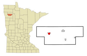
mapsize = 250px
map_caption = Location of Red Lake Falls, Minnesota
mapsize1 =
map_caption1 =subdivision_type = Country
subdivision_name =United States
subdivision_type1 = State
subdivision_name1 =Minnesota
subdivision_type2 = County
subdivision_name2 = Red Lakegovernment_footnotes =
government_type =
leader_title =
leader_name =
leader_title1 =
leader_name1 =
established_title =
established_date =unit_pref = Imperial
area_footnotes =area_magnitude =
area_total_km2 = 5.5
area_land_km2 = 5.5
area_water_km2 = 0.0
area_total_sq_mi = 2.1
area_land_sq_mi = 2.1
area_water_sq_mi = 0.0population_as_of = 2000
population_footnotes =
population_total = 1590
population_density_km2 = 289.5
population_density_sq_mi = 749.7timezone = Central (CST)
utc_offset = -6
timezone_DST = CDT
utc_offset_DST = -5
elevation_footnotes =
elevation_m = 316
elevation_ft = 1037
latd = 47 |latm = 52 |lats = 58 |latNS = N
longd = 96 |longm = 16 |longs = 23 |longEW = Wpostal_code_type =
ZIP code
postal_code = 56750
area_code = 218
blank_name = FIPS code
blank_info = 27-53476GR|2
blank1_name = GNIS feature ID
blank1_info = 0649866GR|3
website =
footnotes =Red Lake Falls is a city in Red Lake County,
Minnesota ,United States . The population was 1,590 at the 2000 census. It is thecounty seat of Red Lake County.GR|6 The city lies in the middle of Red Lake Falls Township from which it was separated when incorporated as a village in 1881. Its status was raised to that of a city in 1898.Geography
Red Lake Falls is located on a tributary of the
Red River of the North , theRed Lake River , at its confluence with theClearwater River . According to theUnited States Census Bureau , the city has a total area of 2.1square mile s (5.5km² ), all of it land.Minnesota Highway 32 serves as a main route in the city. Minnesota Highway 92 is nearby.
History
Red Lake Falls was the site of a
North West Company fur post as early as 1796 or 1797, making it one of the oldest sites of European occupation in the State ofMinnesota . AFrench Canadian fur trader,Jean Baptiste Cadotte , the son of the noted British-Canadian fur trader,Alexander Henry , established the post as part of a strategy to ward offHudson's Bay Company intrusion into theRed River Valley . The post was abandoned early in the 1800s, as British fur traders withdrew from United States territory.The surrounding territory was homesteaded by French-American settlers led by
Pierre Bottineau , who were relocating via ox cart from their temporary stopping points in Ramsey and Hennepin Counties, Minnesota, in 1876. These pioneers were augmented in 1878 by a number of French Canadian settlers fromUpper Canada . The area developed as a grain farming region. In 1878, Earnest Buse and his partner, Otto Kankel, established a flour mill at the confluence of the two rivers.The town of Red Lake Falls soon after was platted by Mr. Buse, who then moved on to other environs. (The Kankel family continued as a prominent presence in the town through the 1950s). The town prospered for a time, as both the
Northern Pacific Railroad and theGreat Northern Railway ran their lines through the town in the 1880s and early 1890s (both lines are now abandoned), and when Red Lake County split off from Polk County, in 1896, Red Lake Falls became the county seat of the newly formed county, a reason for existence that persists to the present day. The population peaked shortly afterwards, in 1900, and has been in decline ever since.The last significant historic event in Red Lake Falls occurred on August 27, 1927, when the famous aviator,
Charles Lindberg and his wife, landed at the nearby airport during a barnstorming trip through the Upper Midwest and were taken on automobile rides to Huot and Crookston.Demographics
As of the
census GR|2 of 2000, there were 1,590 people, 608 households, and 380 families residing in the city. Thepopulation density was 749.7 people per square mile (289.6/km²). There were 652 housing units at an average density of 307.4/sq mi (118.7/km²). The racial makeup of the city was 94.53% White, 4.53% Native American, 0.13% Asian, 0.31% from other races, and 0.50% from two or more races. Hispanic or Latino of any race were 0.44% of the population.There were 608 households out of which 33.1% had children under the age of 18 living with them, 49.2% were married couples living together, 9.5% had a female householder with no husband present, and 37.5% were non-families. 32.7% of all households were made up of individuals and 16.6% had someone living alone who was 65 years of age or older. The average household size was 2.35 and the average family size was 3.00.
In the city the population was spread out with 25.4% under the age of 18, 8.2% from 18 to 24, 24.5% from 25 to 44, 20.4% from 45 to 64, and 21.5% who were 65 years of age or older. The median age was 39 years. For every 100 females there were 92.0 males. For every 100 females age 18 and over, there were 87.7 males.
The median income for a household in the city was $30,536, and the median income for a family was $41,413. Males had a median income of $29,792 versus $20,185 for females. The
per capita income for the city was $15,177. About 8.3% of families and 11.4% of the population were below thepoverty line , including 11.3% of those under age 18 and 16.9% of those age 65 or over.References
Further reading
*Red Lake County Historical Society, Inc., "A History of Red Lake County" (1976), pp. 108-138.
External links
* [http://www.redlakefalls.com/ Red Lake Falls, MN site]
* [http://www.redlakecountyhistory.org/ History of Red Lake County]
Wikimedia Foundation. 2010.