- Penge East railway station
Infobox London station
name = Penge East
manager =Southeastern
zone = 4
locale =Penge
borough =London Borough of Bromley
start =1 July 1863
platforms = 2
railexits0405 = 0.689
railexits0506 = 0.596
railexits0607 = 1.188
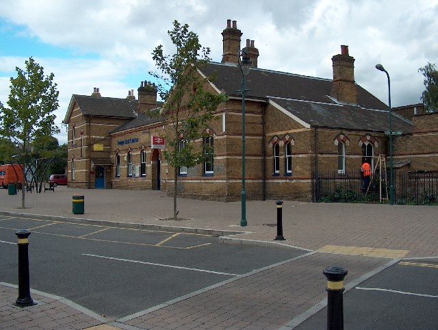
railcode = PNEPenge East railway station is in the
London Borough of Bromley in southLondon . It is inTravelcard Zone 4 , and the station and all trains are operated by Southeastern.The station is 7.2
mile s (11km ) fromLondon Victoria on theChatham Main Line . It was built by theLondon, Chatham and Dover Railway . When the line was built a level crossing was built where the line crossed the old alignment of Penge Lane (now Newlands Park Rd and St John's Rd), but no station was built. An 1885Ordnance Survey map shows that a station had been built, known as Penge Lane Station. When the level crossing was closed Penge Lane was diverted down what are now Thesiger Road, Parish Lane and the current Penge Lane. As parts of Penge Lane adopted new names, the station name became inappropriate and was changed to Penge East.Penge West station is a short walk away, with services to London Bridge. The covered
footbridge with its corrugated roof dates from the 1940s and is a listed structure. The station is close to the South-Eastern portal of Sydenham Hill Railway Tunnel.Services
The typical off-peak service is four trains an hour northbound to London Victoria (via Herne Hill and Brixton) and four trains an hour southbound to
Orpington (via Bromley South).External links
Wikimedia Foundation. 2010.