Kløfta Station

Kløfta Station

Infobox Norwegian station
name = Kløfa
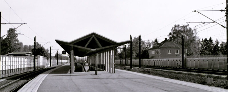


caption = Kløfta station from the end of the platform
locale = Kløfta
municipality = Ullensaker
line = Gardermobanen
Hovedbanen
distance = 36.48 km
elevation = 168.5 m asl
coordinates = coord|60.074775|11.139278
start = 1854
architect =
platforms = 2
owner = Jernbaneverket
operator = Norges Statsbaner
t-bane =
line1 =
line2 =
line3 =
line4 =
line5 =
line6 =
airport =
tram =
bus = Ruter|

Kløfta station is a train station at Kløfta which was opened in 1854 as a part of Norways first railway, Hovedbanen with endpoints at Kristiania and Eidsvoll [ [http://www.jernbaneverket.no/jernbanenettet/stasjonssok/stasjonsoversikt/article.jhtml?articleID=1539632 Jernbaneverkets informasjonssider(Norwegian)] ]

The station was originally called Kløften, but was renamed to Kløfta in 1920. A new station was built at Kløfta as part of the building of the Gardermobanen in 1998. [ [http://forsk.njk.no/stdb/index.php?Stnr=1113&aut=&mod=st&sid=295 Stasjonsdatabasen(Norwegian)] ]

References

Nsb next line
line = Hovedbanen
prestation = Lindeberg
poststation = Jessheim
Nsb next line
line = Gardermobanen
prestation = Lillestrøm
poststation = Oslo Airport
Nsb next local oslo
line440 = yes
line450 = yes
pre440 = Lindeberg
pre450 = Frogner
post440 = Jessheim
post450 = Oslo Airport
prespan440 = 1
postspan440 = 1
prespan450 = 1
postspan450 = 1


Wikimedia Foundation. 2010.

Игры ⚽ Поможем решить контрольную работу

Look at other dictionaries:

  • Oslo Airport Station — For the military air base, see Gardermoen Air Station. Oslo Airport Oslo Airport Express Train platform Location Place Gardermoen Municipality …   Wikipedia

  • Jessheim Station — Jessheim Jessheim station Location Place Jessheim Municipality Ullensaker …   Wikipedia

  • Lindeberg Station — Infobox Norwegian station name = Lindeberg caption = locale = Lindeberg municipality = Sørum line = Hovedbanen distance = 32.39 km elevation = 153 m asl coordinates = start = 1944 architect = platforms = owner = Jernbaneverket operator = Norges… …   Wikipedia

  • Frogner Station — Infobox Norwegian station name = Frogner caption = locale = Frogner municipality = line = Hovedbanen distance = 29.86 km elevation = 124.7 m asl coordinates = start = 1854 architect = platforms = 2 owner = Jernbaneverket operator = Norges… …   Wikipedia

  • Oslo Commuter Rail — Info Owner Norwegian National Rail Administration …   Wikipedia

  • Nitelva — at Nittedal Nitelva is a river which rises at Grua which runs down to Harestuvatnet in the southern part of Lunner municipality in Oppland. The river then flows southwards and ends at Øyeren. The river has at this point run for around 37 km, and… …   Wikipedia

  • Norwegian National Road 159 — Riksvei 159 …   Wikipedia

  • Gardermoen Line — Eidsvoll Verk Station Overview Type High speed railway Termini …   Wikipedia

  • Gardermo Line — Infobox rail line name = Gardermo Line nativename = Gardermobanen caption = Eidsvoll Verk Station type = High speed railway start = Oslo Central Station end = Eidsvoll Station stations = 5 open = 8 October 1998 owner = Norwegian National Rail… …   Wikipedia

  • Ullensaker — Infobox Kommune name=Ullensaker idnumber=0235 county=Akershus landscape=Romerike capital=Jessheim governor=Harald Espelund (Frp) governor as of=2003 arearank=301 area=252 arealand=250 areapercent=0.08 population as of=2004 populationrank=36… …   Wikipedia

Share the article and excerpts

Direct link
Do a right-click on the link above
and select “Copy Link”