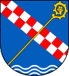
Gmina Marciszów

Gmina Marciszów
Gmina Marciszów
Marciszów Commune
—  Gmina  —

Flag

Coat of arms
Coordinates (Marciszów): 50°50′33″N 16°1′57″E / 50.8425°N 16.0325°E / 50.8425; 16.0325Coordinates: 50°50′33″N 16°1′57″E / 50.8425°N 16.0325°E / 50.8425; 16.0325
Country  Poland
Voivodeship Lower Silesian
County Kamienna Góra
Seat Marciszów
Sołectwos Ciechanowice, Domanów, Marciszów, Nagórnik, Pastewnik, Pustelnik, Sędzisław, Świdnik, Wieściszowice
Area
 – Total 81.98 km2 (31.7 sq mi)
Population (2006)
 – Total 4,728
 – Density 57.7/km2 (149.4/sq mi)
Website http://www.marciszow.pl

Gmina Marciszów is a rural gmina (administrative district) in Kamienna Góra County, Lower Silesian Voivodeship, in south-western Poland. Its seat is the village of Marciszów, which lies approximately 4 kilometres (2 mi) north-west of Kamienna Góra and 78 km (48 mi) south-west of the regional capital Wrocław.

The gmina covers an area of 81.98 square kilometres (31.7 sq mi), and as of 2006 its total population is 4,728.

Neighbouring gminas

Gmina Marciszów is bordered by the gminas of Bolków, Czarny Bór, Janowice Wielkie, Kamienna Góra and Stare Bogaczowice.

Villages

The gmina contains the villages of Ciechanowice, Domanów, Marciszów, Nagórnik, Pastewnik, Pustelnik, Sędzisław, Świdnik and Wieściszowice.

References


Wikimedia Foundation. 2010.

Игры ⚽ Нужен реферат?

Look at other dictionaries:

  • Marciszów —   Village   …   Wikipedia

  • Marciszów — Marciszów …   Deutsch Wikipedia

  • Gmina Czarny Bór — Czarny Bór Commune   Gmina   …   Wikipedia

  • Gmina Bolków — Infobox Settlement name=Gmina Bolków other name=Bolków Commune settlement type=Gmina image shield=POL gmina Bolków COA.svg subdivision type=Country subdivision name=POL subdivision type1=Voivodeship subdivision name1=Lower Silesian subdivision… …   Wikipedia

  • Gmina Kamienna Góra — Infobox Settlement name = Gmina Kamienna Góra other name = Kamienna Góra Commune settlement type = Gmina subdivision type = Country subdivision name = POL subdivision type1 = Voivodeship subdivision name1 = Lower Silesian subdivision type2 =… …   Wikipedia

  • Gmina Janowice Wielkie — Infobox Settlement name=Gmina Janowice Wielkie other name=Janowice Wielkie Commune settlement type=Gmina subdivision type=Country subdivision name=POL subdivision type1=Voivodeship subdivision name1=Lower Silesian subdivision type2=County… …   Wikipedia

  • Gmina Stare Bogaczowice — Infobox Settlement name = Gmina Stare Bogaczowice other name = Stare Bogaczowice Commune settlement type = Gmina total type = Total image shield = Stare Bogaczowice Herb.png subdivision type = Country subdivision name = POL subdivision type1 =… …   Wikipedia

  • List of Polish gminas/M — *Gmina Maciejowice (rural, Garwolin County, Masovian Voivodeship, 172.67 km², 7,287) *Gmina Magnuszew (rural, Kozienice County, Masovian Voivodeship, 140.92 km², 6,595) *Gmina Majdan Królewski (rural, Kolbuszowa County, Subcarpathian Voivodeship …   Wikipedia

  • Nagórnik, Lower Silesian Voivodeship — For other places with the same name, see Nagórnik (disambiguation). Nagórnik   Village   …   Wikipedia

  • Ciechanowice —   Village   …   Wikipedia

Share the article and excerpts

Direct link
Do a right-click on the link above
and select “Copy Link”