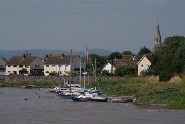
- Combwich
-
Coordinates: 51°10′36″N 3°04′02″W / 51.1768°N 3.0671°W
Combwich 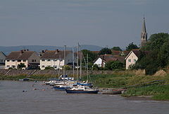
Combwich Harbour
 Combwich
Combwich shown within SomersetOS grid reference ST255425 District Sedgemoor Shire county Somerset Region South West Country England Sovereign state United Kingdom Post town BRIDGWATER Postcode district TA5 Dialling code 01278 Police Avon and Somerset Fire Devon and Somerset Ambulance South Western EU Parliament South West England UK Parliament Bridgwater and West Somerset List of places: UK • England • Somerset Combwich (pronounced "Cummidge")[1] is a village in the parish of Otterhampton within the Sedgemoor district of Somerset, between Bridgwater and the Steart Peninsula.
The village lies on Combwich Reach as the River Parrett flows to the sea and was the site of an ancient ferry crossing.[1] In the Domesday book it was known as Comich which means 'The settlement by the water' from the Old English cumb and wic. It was here, or in the immediate vicinity, that Hubba, the Danish raider, was defeated and killed by Earl Oddune of Devon in 878.[2]
It served as a port for the export of local produce and the import of timber from the 15th century. It also served the local brick and coal yard until the creek silted up in the 1930s.[1] Brick and tile making was first recorded in the village in 1842.[3]
The Steart peninsula has flooded many times during the last millennium. The most severe recent floods occurred in 1981. By 1997, a combination of coastal erosion, sea level rise and wave action had made some of the defences distinctly fragile and at risk from failure. As a result in 2002 The Environment Agency produced the Stolford to Combwich Coastal Defence Strategy Study to examine options for the future.[4]
External links
References
- ^ a b c Farr, Grahame (1954). Somerset Harbours. London: Christopher Johnson. pp. 117–118.
- ^ Robinson, Stephen (1992). Somerset Place Names. Dovecote Press. ISBN 1874336032.
- ^ Waite, Vincent (1964). Portrait of the Quantocks. London: Robert Hale. ISBN 0709111584.
- ^ "Stolford to Combwich Coastal Defence Strategy Study" (PDF). Environment Agency. Archived from the original on 2007-09-27. http://web.archive.org/web/20070927182252/http://www.environment-agency.gov.uk/commondata/acrobat/stolford_to_combwich.pdf.pdf. Retrieved 2007-10-31.
Categories:- Villages in Sedgemoor
- Somerset Levels
- Ports and harbours of Somerset

Wikimedia Foundation. 2010.