- Fort Ripley, Minnesota
Infobox Settlement
official_name = Fort Ripley, Minnesota
settlement_type =City
nickname =
motto =
imagesize =
image_caption =
image_
imagesize =
image_caption =
image_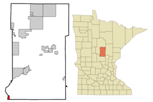
mapsize = 250px
map_caption = Location of Fort Ripley, Minnesota
mapsize1 =
map_caption1 =subdivision_type = Country
subdivision_name =United States
subdivision_type1 = State
subdivision_name1 =Minnesota
subdivision_type2 = County
subdivision_name2 = Crow Winggovernment_footnotes =
government_type =
leader_title =
leader_name =
leader_title1 =
leader_name1 =
established_title =
established_date =unit_pref = Imperial
area_footnotes =area_magnitude =
area_total_km2 = 3.7
area_land_km2 = 3.4
area_water_km2 = 0.3
area_total_sq_mi = 1.4
area_land_sq_mi = 1.3
area_water_sq_mi = 0.1population_as_of = 2000
population_footnotes =
population_total = 74
population_density_km2 = 21.5
population_density_sq_mi = 55.6timezone = Central (CST)
utc_offset = -6
timezone_DST = CDT
utc_offset_DST = -5
elevation_footnotes =
elevation_m = 356
elevation_ft = 1168
latd = 46 |latm = 10 |lats = 13 |latNS = N
longd = 94 |longm = 21 |longs = 46 |longEW = Wpostal_code_type =
ZIP code
postal_code = 56449
area_code = 218
blank_name = FIPS code
blank_info = 27-21932GR|2
blank1_name = GNIS feature ID
blank1_info = 0643824GR|3
website =
footnotes =Fort Ripley is a city in Crow Wing County,
Minnesota ,United States , near the confluence of the Mississippi and Nokasippi Rivers. The population was 74 at the 2000 census. It is part of the Brainerd Micropolitan Statistical Area.Geography
According to the
United States Census Bureau , the city has a total area of 1.4square mile s (3.7km² ), of which, 1.3 square miles (3.4 km²) of it is land and 0.1 square miles (0.3 km²) of it (7.64%) is water.Minnesota State Highway 371 serves as a main route in the community.Demographics
As of the
census GR|2 of 2000, there were 74 people, 34 households, and 24 families residing in the city. Thepopulation density was 55.6 people per square mile (21.5/km²). There were 35 housing units at an average density of 26.3/sq mi (10.2/km²). The racial makeup of the city was 94.59% White, 1.35% Native American, 1.35% from other races, and 2.70% from two or more races. Hispanic or Latino of any race were 4.05% of the population.There were 34 households out of which 11.8% had children under the age of 18 living with them, 61.8% were married couples living together, 2.9% had a female householder with no husband present, and 29.4% were non-families. 23.5% of all households were made up of individuals and 5.9% had someone living alone who was 65 years of age or older. The average household size was 2.18 and the average family size was 2.46.
In the city the population was spread out with 9.5% under the age of 18, 8.1% from 18 to 24, 25.7% from 25 to 44, 44.6% from 45 to 64, and 12.2% who were 65 years of age or older. The median age was 48 years. For every 100 females there were 124.2 males. For every 100 females age 18 and over, there were 123.3 males.
The median income for a household in the city was $37,250, and the median income for a family was $40,750. Males had a median income of $33,542 versus $26,250 for females. The
per capita income for the city was $18,559. There were 11.1% of families and 6.8% of the population living below thepoverty line , including no under eighteens and none of those over 64.References
Wikimedia Foundation. 2010.