- Washington State Route 8
Infobox WA State Route|route=8|sec=035
length_mi=20.67
length_ref=
length_round=2
dir1=West
dir2=East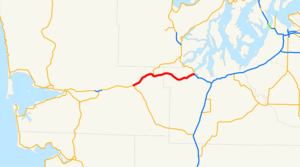
formed=1967
from=
junction=
to=
type=State
previous_route=7|previous_type=State|next_type=State|next_route=9State Route 8 (SR 8) is a short
state highway connecting U.S. Route 12 in Elma,Washington to U.S. Route 101 near Olympia,Washington .Route description
State Route 8 begins as an expressway running east from US 12 and goes through the town of McCleary. It interchanges with State Route 108, the road to Shelton. Then it goes by Summit Lake and Capitol State Forest. During this segment there are at-grade intersections. Finally, it merges with US 101 southbound near Olympia. However, to get onto US 101 northbound, one must exit the freeway after the merge and get back on going the other direction.
History
From 1926 to 1967, State Route 8 was part of U.S. Route 410. At that time, US 12 did not enter Washington, and US 410 ran from Aberdeen to
Lewiston, Idaho , via what is now US 12, SR 8, I-5, SR 167, SR 410, and again US 12. In 1967, US 410 was dropped from theU.S. Highway system , and US 12 was extended westward from Lewiston to take over most of its routing.From the 1964 renumbering until 1967, State Route 8 referred to the section of what is now US 12 from Elma to Interstate 5 in Grand Mound.
Prior to 1964, current SR 8 from Elma to Mud Bay was part of Primary State Highway 9 (in addition to US 410). Former SR 8 from Elma to Grand Mound was the Grand Mound branch of PSH 9.
Major intersections
References
External links
* [http://www.angelfire.com/wa2/hwysofwastate/sr801.html Highways of Washington State – State Route 801]

Wikimedia Foundation. 2010.