- Harris, Minnesota
Infobox Settlement
official_name = Harris, Minnesota
settlement_type =City
nickname =
motto =
imagesize =
image_caption =
image_
imagesize =
image_caption =
image_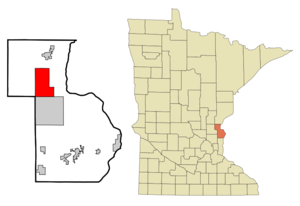
mapsize = 250px
map_caption = Location of Harris, Minnesota
mapsize1 =
map_caption1 =subdivision_type = Country
subdivision_name =United States
subdivision_type1 = State
subdivision_name1 =Minnesota
subdivision_type2 = County
subdivision_name2 = Chisagogovernment_footnotes =
government_type =
leader_title = Mayor
leader_name = Rick Smisson
leader_title1 =
leader_name1 =
established_title =
established_date =unit_pref = Imperial
area_footnotes =area_magnitude =
area_total_km2 = 51.4
area_land_km2 = 51.2
area_water_km2 = 0.2
area_total_sq_mi = 19.9
area_land_sq_mi = 19.8
area_water_sq_mi = 0.1population_as_of = 2000
population_footnotes =
population_total = 1121
population_density_km2 = 21.9
population_density_sq_mi = 56.7timezone = Central (CST)
utc_offset = -6
timezone_DST = CDT
utc_offset_DST = -5
elevation_footnotes =
elevation_m = 276
elevation_ft = 906
latd = 45 |latm = 35 |lats = 37 |latNS = N
longd = 92 |longm = 58 |longs = 49 |longEW = Wpostal_code_type =
ZIP code
postal_code = 55032
area_code = 651
blank_name = FIPS code
blank_info = 27-27278GR|2
blank1_name = GNIS feature ID
blank1_info = 0644685GR|3
website = http://www.harrismn.com/
footnotes =Harris is a city in Chisago County,
Minnesota ,United States . The population was 1,121 at the 2000 census. It was named after Philip S. Harris, an officer of the St. Paul – Duluth Railroad Company.Interstate 35 serves as a main arterial route for the community.Geography
According to the
United States Census Bureau , the city has a total area of 19.9square mile s (51.4km² ), of which, 19.8 square miles (51.2 km²) of it is land and 0.1 square miles (0.2 km²) of it (0.40%) is water.Demographics
As of the
census GR|2 of 2000, there were 1,121 people, 377 households, and 286 families residing in the city. Thepopulation density was 56.7 people per square mile (21.9/km²). There were 393 housing units at an average density of 19.9/sq mi (7.7/km²). The racial makeup of the city was 97.77% White, 0.36% African American, 0.45% Native American, 0.27% Asian, 0.54% from other races, and 0.62% from two or more races. Hispanic or Latino of any race were 1.52% of the population.There were 377 households out of which 42.7% had children under the age of 18 living with them, 63.4% were married couples living together, 6.4% had a female householder with no husband present, and 23.9% were non-families. 19.6% of all households were made up of individuals and 8.5% had someone living alone who was 65 years of age or older. The average household size was 2.97 and the average family size was 3.37.
In the city the population was spread out with 32.7% under the age of 18, 6.7% from 18 to 24, 33.0% from 25 to 44, 19.5% from 45 to 64, and 8.0% who were 65 years of age or older. The median age was 34 years. For every 100 females there were 114.3 males. For every 100 females age 18 and over, there were 111.2 males.
The median income for a household in the city was $49,545, and the median income for a family was $51,719. Males had a median income of $37,917 versus $25,703 for females. The
per capita income for the city was $18,258. About 1.8% of families and 4.9% of the population were below thepoverty line , including 3.5% of those under age 18 and 15.6% of those age 65 or over.History
Timeline of events contributing to the establishment of present-day Harris.
* 1783 – Britain ceded the area to the United States.
* 1787 –Northwest Territory created, including area to become Harris.
* 1789 – Northwest Territory affirmed.
* 1836 –Wisconsin Territory established, including area to become Harris.
* 1849 –Minnesota Territory established, including area to become Harris.
* 1851 – Chisago County created as the fifth Minnesota County.
* 1858 –Minnesota became the 32nd state.
* 1858 – Sunrise Township established including all of today’s Sunrise Township, Harris, Fish Lake, Branch City and North Branch. [Harris Centennial Committee 1984, p. 9. ]
* 1870 – Railroad completed between St. Paul and Duluth. [Chisago County Bicentennial Committee 1976, p. 239.]
* 1874 – Post Office established.
* 1882 – Charter organized Harris village.
* 1884 – Town of Harris organized.
* 1904 – Harris starch factory built.
* 1949 – Stark Field donated.
* 1950 – Harris Volunteer Fire Department established.
* 1969 –Interstate 35 opened from Lino Lakes to Rock Creek with an exit at Harris.Notes
References
* Chisago County Bicentennial Committee (1976). “An early look at Chisago County”, Review Corporation, North Branch, Minnesota.
* Edwards, Elijah Evan and Folsom, William Hanery Carman (1888). "Fifty Years in the Northwest: With and Introdution and Appendix Containing Reminiscenses, Incidents and Notes", Pioneer Press Co.
* Harris Centennial Committee (1984). “Harris Centennial: 1884-1984”, Coordinated by: Irene Martinson and Inez Hanson, Review Corporation, North Branch, Minnesota.
Wikimedia Foundation. 2010.