- Cass Lake, Minnesota
Infobox Settlement
official_name = Cass Lake, Minnesota
settlement_type =City
nickname =
motto =
imagesize =
image_caption =
image_
imagesize =
image_caption =
image_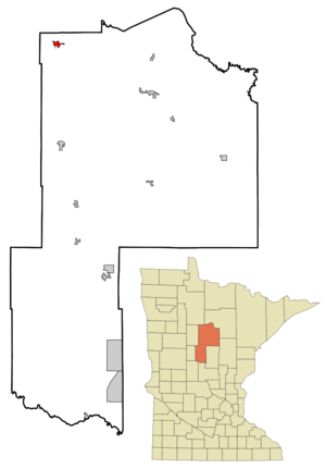
mapsize = 250px
map_caption = Location of Cass Lake, Minnesota
mapsize1 =
map_caption1 =subdivision_type = Country
subdivision_name =United States
subdivision_type1 = State
subdivision_name1 =Minnesota
subdivision_type2 = County
subdivision_name2 = Cassgovernment_footnotes =
government_type =
leader_title =
leader_name =
leader_title1 =
leader_name1 =
established_title =
established_date =unit_pref = Imperial
area_footnotes =area_magnitude =
area_total_km2 = 3.0
area_land_km2 = 3.0
area_water_km2 = 0.0
area_total_sq_mi = 1.1
area_land_sq_mi = 1.1
area_water_sq_mi = 0.0population_as_of = 2000
population_footnotes =
population_total = 860
population_density_km2 = 290.8
population_density_sq_mi = 753.2timezone = Central (CST)
utc_offset = -6
timezone_DST = CDT
utc_offset_DST = -5
elevation_footnotes =
elevation_m = 406
elevation_ft = 1332
latd = 47 |latm = 22 |lats = 43 |latNS = N
longd = 94 |longm = 36 |longs = 14 |longEW = Wpostal_code_type =
ZIP code
postal_code = 56633
area_code = 218
blank_name = FIPS code
blank_info = 27-10252GR|2
blank1_name = GNIS feature ID
blank1_info = 0655663GR|3
website =
footnotes =Cass Lake is a city in Cass County,
Minnesota ,United States , within the reservation boundaries of theLeech Lake Band of theOjibwe nation.—, "Progressive City Leaders", "The Nation", June 18, 2005, p.18-19.] The population was 860 at the 2000 census.The city is a Superfund site, due to toxic waste from the
St. Regis Paper Company . The previous mayor,Elaine Fleming , is the first Native American to hold that position.Cass Lake is part of the Brainerd Micropolitan Statistical Area.
Geography
According to the
United States Census Bureau , the city has a total area of 1.1square mile s (3.0km² ), all of it land.U.S. Route 2 andMinnesota State Highway 371 are two of the main routes in the city.Demographics
As of the
census GR|2 of 2000, there were 860 people, 331 households, and 192 families residing in the city. Thepopulation density was 753.2 people per square mile (291.3/km²). There were 384 housing units at an average density of 336.3/sq mi (130.1/km²). The racial makeup of the city was 30.12% White, 64.42% Native American, 0.23% from other races, and 5.23% from two or more races. Hispanic or Latino of any race were 1.74% of the population.There were 331 households out of which 32.0% had children under the age of 18 living with them, 24.2% were married couples living together, 27.2% had a female householder with no husband present, and 41.7% were non-families. 38.1% of all households were made up of individuals and 19.9% had someone living alone who was 65 years of age or older. The average household size was 2.59 and the average family size was 3.40.
In the city the population was spread out with 36.2% under the age of 18, 9.9% from 18 to 24, 23.1% from 25 to 44, 16.5% from 45 to 64, and 14.3% who were 65 years of age or older. The median age was 28 years. For every 100 females there were 85.7 males. For every 100 females age 18 and over, there were 76.5 males.
The median income for a household in the city was $20,583, and the median income for a family was $23,977. Males had a median income of $22,614 versus $20,066 for females. The
per capita income for the city was $9,569. About 25.4% of families and 29.0% of the population were below thepoverty line , including 32.0% of those under age 18 and 29.4% of those age 65 or over.References
External links
* [http://www.casslake.com/ Cass Lake Chamber of Commerce]
Wikimedia Foundation. 2010.