- Blackduck, Minnesota
Infobox Settlement
official_name = Blackduck, Minnesota
settlement_type =City
nickname =
motto =
imagesize =
image_caption =
image_
imagesize =
image_caption =
image_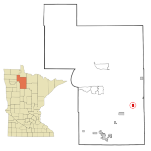
mapsize = 250px
map_caption = Location of Blackduck, Minnesota
mapsize1 =
map_caption1 =subdivision_type = Country
subdivision_name =United States
subdivision_type1 = State
subdivision_name1 =Minnesota
subdivision_type2 = County
subdivision_name2 = Beltramigovernment_footnotes =
government_type =
leader_title =
leader_name =
leader_title1 =
leader_name1 =
established_title =
established_date =unit_pref = Imperial
area_footnotes =area_magnitude =
area_total_km2 = 4.0
area_land_km2 = 3.9
area_water_km2 = 0.1
area_total_sq_mi = 1.5
area_land_sq_mi = 1.5
area_water_sq_mi = 0.0population_as_of = 2000
population_footnotes =
population_total = 696
population_density_km2 = 179.8
population_density_sq_mi = 465.8timezone = Central (CST)
utc_offset = -6
timezone_DST = CDT
utc_offset_DST = -5
elevation_footnotes =
elevation_m = 426
elevation_ft = 1398
latd = 47 |latm = 43 |lats = 49 |latNS = N
longd = 94 |longm = 32 |longs = 52 |longEW = Wpostal_code_type =
ZIP code s
postal_code = 56630, 56663
area_code = 218
blank_name = FIPS code
blank_info = 27-06256GR|2
blank1_name = GNIS feature ID
blank1_info = 0655419GR|3
website =
footnotes =Blackduck is a city in Beltrami County,
Minnesota ,United States . The population was 696 as of the 2000 census.Geography
According to the
United States Census Bureau , the city has a total area of 1.5square mile s (4.0km² ), of which, 1.5 square miles (3.9 km²) is land and 0.04 square miles (0.1 km²) (1.96%) is water. Fact|date=September 2008Demographics
As of the
census GR|2 of 2000, there were 696 people, 304 households, and 175 families residing in the city. Thepopulation density was 465.8 people per square mile (180.4/km²). There were 324 housing units at an average density of 216.8/sq mi (84.0/km²). The racial makeup of the city was 92.10% White, 0.86% African American, 3.45% Native American, 0.14% Asian, 0.14% from other races, and 3.30% from two or more races. Hispanic or Latino of any race were 0.72% of the population.There were 304 households out of which 26.0% had children under the age of 18 living with them, 40.1% were married couples living together, 14.5% had a female householder with no husband present, and 42.4% were non-families. 37.8% of all households were made up of individuals and 19.7% had someone living alone who was 65 years of age or older. The average household size was 2.14 and the average family size was 2.81.
In the city the population was spread out with 24.6% under the age of 18, 9.1% from 18 to 24, 22.0% from 25 to 44, 15.8% from 45 to 64, and 28.6% who were 65 years of age or older. The median age was 40 years. For every 100 females there were 68.9 males. For every 100 females age 18 and over, there were 64.1 males.
The median income for a household in the city was $21,848, and the median income for a family was $29,750. Males had a median income of $28,594 versus $16,838 for females. The
per capita income for the city was $12,536. About 11.6% of families and 16.9% of the population were below thepoverty line , including 18.5% of those under age 18 and 15.8% of those age 65 or over.Trivia
*The fictional
GI Joe character Charbroil is from Blackduck.References
External links
* [http://www.blackduckmn.com/ Blackduck Community Website]
Wikimedia Foundation. 2010.